- Minnehaha County
-
Verwaltung US-Bundesstaat: South Dakota Verwaltungssitz: Sioux Falls Gründung: 1830 Demographie Einwohner: 148.281 (2005) Bevölkerungsdichte: 70,7 Einwohner/km² Geographie Fläche gesamt: 2.107 km² Wasserfläche: 10 km² Karte 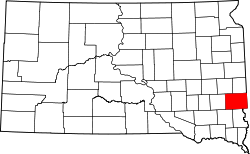
Minnehaha County[1] ist ein County im Bundesstaat South Dakota der Vereinigten Staaten von Amerika. 2000 lebten hier 148.281 Menschen. Minnehaha kommt aus der Sprache der Sioux-Indianer und bedeutet Wasserfall, die Hauptstadt des Bezirkes, Sioux Falls ist ebenfalls nach den Wasserfällen des Flusses Big Sioux River benannt. Der Sitz der Countyverwaltung (County Seat) ist in Sioux Falls.
Inhaltsverzeichnis
Geographie
Der Bezirk hat eine Fläche von 2107 Quadratkilometern; davon sind 10 Quadratkilometer (0,49 Prozent) Wasserflächen. Er ist in 24 Townships eingeteilt: Brandon, Benton, Buffalo, Burk, Clear Lake, Dell Rapids, Edison, Grand Meadow, Hartford, Highland, Humboldt, Logan, Lyons, Mapleton, Palisade, Red Sock, Sioux Falls, Split Rock, Sverdrup, Taopi, Valley Springs, Wall Lake, Wyne und Wellington.
Bevölkerungsentwicklung
Historische Einwohnerzahlen Census Einwohner ± in % 1870 355 — 1880 8251 2.000 % 1890 21.879 200 % 1900 23.926 9 % 1910 29.631 20 % 1920 42.490 40 % 1930 50.872 20 % 1940 57.697 10 % 1950 70.910 20 % 1960 86.575 20 % 1970 95.209 10 % 1980 109.435 10 % 1990 123.809 10 % 2000 148.281 20 % 2010 169.468 10 % Vor 1900[2] Orte
Städte (cities)
- Baltic
- Brandon
- Colton
- Crooks
- Dell Rapids
- Garretson
- Hartford
- Sioux Falls
- Valley Springs
Gemeinden (towns)
- Humboldt
- Sherman
Gemeindefreie Gebiete (Unincorporated communities)
- Benclare
- Booge
- Corson
- Ellis
- Huntimer
- Lyons
- Renner
- Rowena
Einzelnachweise
- ↑ Minnehaha County im Geographic Names Information System des United States Geological Survey. Abgerufen am 22. Februar 2011
- ↑ U.S. Census Bureau _ Census of Population and Housing. Abgerufen am 28. Februar 2011
- ↑ Auszug aus Census.gov. Abgerufen am 28. Februar 2011
- ↑ Auszug aus factfinder.census.gov Abgerufen am 28. Februar 2011

Liste der Countys in South Dakota
Aurora | Beadle | Bennett | Bon Homme | Brookings | Brown | Brule | Buffalo | Butte | Campbell | Charles Mix | Clark | Clay | Codington | Corson | Custer | Davison | Day | Deuel | Dewey | Douglas | Edmunds | Fall River | Faulk | Grant | Gregory | Haakon | Hamlin | Hand | Hanson | Harding | Hughes | Hutchinson | Hyde | Jackson | Jerauld | Jones | Kingsbury | Lake | Lawrence | Lincoln | Lyman | Marshall | McCook | McPherson | Meade | Mellette | Miner | Minnehaha | Moody | Pennington | Perkins | Potter | Roberts | Sanborn | Shannon | Spink | Stanley | Sully | Todd | Tripp | Turner | Union | Walworth | Yankton | Ziebach
Wikimedia Foundation.
Schlagen Sie auch in anderen Wörterbüchern nach:
Minnehaha County — Admin ASC 2 Code Orig. name Minnehaha County Country and Admin Code US.SD.099 US … World countries Adminstrative division ASC I-II
Minnehaha County, South Dakota — Minnehaha County Courthouse in Sioux Falls, South Dakota … Wikipedia
Minnehaha County (South Dakota) — Verwaltung US Bundesstaat: South Dakota Verwaltungssitz: Sioux Falls Adresse des Verwaltungssitzes: Gründung … Deutsch Wikipedia
National Register of Historic Places listings in Minnehaha County, South Dakota — Location of Minnehaha County in South Dakota This is a list of the National Register of Historic Places listings in Minnehaha County, South Dakota. This is intended to be a complete list of the properties and districts on the National Register of … Wikipedia
Minnehaha (disambiguation) — Minnehaha is a mythical Native American character. Minnehaha can also refer to: Locations: Minnehaha, Arizona Minnehaha, Colorado In Minnesota: Minnehaha Academy Minnehaha Creek Minnehaha Falls Minnehaha Park Minnehaha, Minneapolis, a neighorhood … Wikipedia
Minnehaha — ist der Name mehrerer Orte in den Vereinigten Staaten: Minnehaha (Arizona) Minnehaha (Colorado) Minnehaha (New York) Minnehaha (Washington) Minnehaha (Minneapolis), Stadtteil von Minneapolis Minnehaha Springs (West Virginia) Minnehaha County,… … Deutsch Wikipedia
Minnehaha — For other uses, see Minnehaha (disambiguation). Hiawatha and Minnehaha sculpture by Jacob Fjelde near Minnehaha Falls in Minneapolis, Minnesota. Minnehaha is a fictional Native American woman documented in Henry Wadsworth Longfellow s 1855 epic… … Wikipedia
County statistics of the United States — The counties are used in 48 of the 50 states of the United States for the level of local government below the state itself. Louisiana uses parishes, and Alaska uses boroughs. In several states in New England, some or all counties within states… … Wikipedia
Minnehaha, Washington — CDP Location o … Wikipedia
Minnehaha Falls, Georgia — Minnehaha Falls Minnehaha Falls Location Chattahoochee National Forest in the Chattooga River Ranger District,and near Lake Rabun in Rabun County, Georgia Coordinates … Wikipedia
Minnehaha County

18+
© Academic, 2000-2024
- Kontaktieren Sie uns: Unterstützung, Werbung
Wörterbücher Export, schritte mit PHP, Joomla, Drupal, WordPress, MODx.