Arizona State Route 179

Arizona State Route 179
Straßenschild der Arizona State Route 179
Karte
Karte der Arizona State Route 179
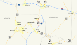
Basisdaten
Gesamtlänge:  14 mi/23 km
Anfangspunkt:  Straßenschild der I-17 I-17 am Exit 298
Endpunkt:  Arizona 89A.svg AZ 89A in Sedona
County:  Yavapai County

Die Arizona State Route 179 (kurz AZ 179) ist ein in nord-südlicher Richtung verlaufender Highway im US-Bundesstaat Arizona.

Der Highway beginnt am Exit 298 der Interstate 17 nördlich von Rimbeck und endet in Sedona an der Arizona State Route 89A. Früher begann die State Route südlich von Camp Verde. Dieser Abschnitt wurde aber bis zum Bau der I-17 aufgelöst. Zwischen Sedona und der I-17 wird die Straße bis 2009 vierspurig ausgebaut.

Siehe auch

Weblinks


Wikimedia Foundation.

Игры ⚽ Нужна курсовая?

Schlagen Sie auch in anderen Wörterbüchern nach:

  • Arizona State Route 179 — Infobox road marker state=AZ highway name= name notes= type=state route=179 alternate name= maint= length mi=14.49 length round=2 length ref=cite web |url=http://tpd.az.gov/data/reports/2006SHSLog.pdf |title=2006 ADOT Highway Log |author=Arizona… …   Wikipedia

  • Arizona State Route 89A — Karte …   Deutsch Wikipedia

  • Arizona State Route 177 — Infobox road marker state=AZ highway name= name notes= type=state route=177 alternate name= maint= length mi=31.69 length round=2 length ref=cite web |url=http://tpd.az.gov/data/reports/2006SHSLog.pdf |title=2006 ADOT Highway Log |author=Arizona… …   Wikipedia

  • Arizona State Route 89A — Infobox road marker state=AZ highway name= name notes= type=state route=89A alternate name= maint=ADOT length mi=79.85 length round=2 length ref=cite web|url=http://tpd.az.gov/data/reports/2006SHSLog.pdf|title=2006 ADOT Highway… …   Wikipedia

  • Arizona State Route 181 — Infobox road marker state=AZ highway name= name notes= type=state route=181 alternate name= maint=ADOT length mi=26.80 length round=2 length ref=cite web |url=http://tpd.az.gov/data/reports/2006SHSLog.pdf |title=2006 ADOT Highway Log… …   Wikipedia

  • Arizona State Highway 89A — Karte …   Deutsch Wikipedia

  • New Mexico State Route 9 — Basisdaten Gesamtlänge:  109 mi/179 km Anfangspunkt:  …   Deutsch Wikipedia

  • Liste der Highways in Arizona — Dies ist eine Aufstellung von State Routes, U.S. Highways und Interstates im US Bundesstaat Arizona, nach Nummern. Inhaltsverzeichnis 1 State Routes 1.1 Gegenwärtige Strecken 1.2 Geplante Strecken 1.3 Außer Die …   Deutsch Wikipedia

  • List of highways numbered 179 — The following highways are numbered 179: United States Alabama State Route 179 Arizona State Route 179 Arkansas Highway 179 …   Wikipedia

  • Arizona — This article is about the U.S. state of Arizona. For other uses, see Arizona (disambiguation). State of Arizona …   Wikipedia

Share the article and excerpts

Direct link
Do a right-click on the link above
and select “Copy Link”