- Sackets Harbor
-
Sackets Harbor 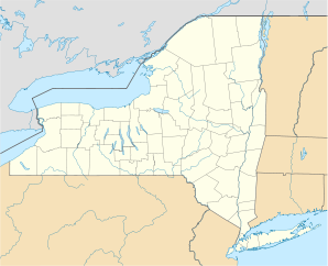

Sackets Harbor Lage in New YorkBasisdaten Gründung: 1801 Staat: Vereinigte Staaten Bundesstaat: New York County: Koordinaten: 43° 57′ N, 76° 7′ W43.946388888889-76.11777777777886Koordinaten: 43° 57′ N, 76° 7′ W Zeitzone: Eastern Standard Time (UTC−5) Einwohner: 1386 (Stand: 2000) Bevölkerungsdichte: 234,9 Einwohner je km² Fläche: 5,9 km² (ca. 2 mi²)
davon 5,9 km² (ca. 2 mi²) LandHöhe: 86 m Postleitzahl: 13685 Vorwahl: +1 315 FIPS: 36-64408 GNIS-ID: 0963166 Webpräsenz: www.sacketsharbor-ny.gov Bürgermeister: Michael R. Kinnie Sackets Harbor ist eine Ortschaft in den USA. Sie liegt an der Mündung des Black River in den Ontariosee, gehört zur Stadtgemeinde Hounsfield und zum Jefferson County im Bundesstaat New York, Vereinigte Staaten. Sackets Harbor hat 1386 Einwohner (Stand 2000).
Sackets Harbor wurde 1801 durch den Landbesitzer Augustus Sacket gegründet und war bis zur Gründung von Watertown die bedeutendste Siedlung in der Region. Im Krieg von 1812 mit Großbritannien hatte Sackets Harbor als Flottenbasis der US Navy und Zentrum des Baus von Kriegsschiffen unter dem Schiffbauer Henry Eckford große strategische Bedeutung. 1812 wehrten die Amerikaner einen ersten Angriff britischer Kriegsschiffe ab, 1813 konnten die Verteidiger unter General Jacob Brown die Einnahme des Orts durch eine großangelegte, aber halbherzig durchgeführte britische Landeoperation unter dem Kommando von Kommodore Sir James Lucas Yeo und dem kanadischen Generalgouverneur Sir George Prevost verhindern. Trotzdem gelang es den Angreifern, erhebliche Schäden anzurichten und den Schiffbau erheblich zurückzuwerfen. Die Schlacht von Sackets Harbor wurde damals und wird teilweise bis heute fälschlicherweise als großer amerikanischer Erfolg dargestellt. Bei den Kämpfen wurde der amerikanische Entdecker und Offizier Zebulon Pike getötet und dort begraben.
Weblinks
Kategorie:- Ort in New York

Wikimedia Foundation.