Sackets Harbor (New York)
- Sackets Harbor (New York)
-
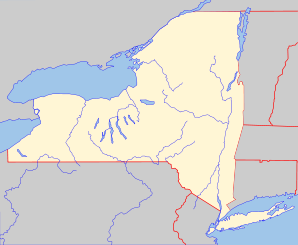
Sackets Harbor ist eine Ortschaft in den USA. Sie liegt an der Mündung des Black River in den Ontariosee, gehört zur Stadtgemeinde Hounsfield und zum Jefferson County im Bundesstaat New York, Vereinigte Staaten. Sackets Harbor hat 1386 Einwohner (Stand 2000).
Sackets Harbor wurde 1801 durch den Landbesitzer Augustus Sacket gegründet und war bis zur Gründung von Watertown die bedeutendste Siedlung in der Region. Im Krieg von 1812 mit Großbritannien hatte Sackets Harbor als Flottenbasis der US Navy und Zentrum des Baus von Kriegsschiffen unter dem Schiffbauer Henry Eckford große strategische Bedeutung. 1812 wehrten die Amerikaner einen ersten Angriff britischer Kriegsschiffe ab, 1813 konnten die Verteidiger unter General Jacob Brown die Einnahme des Orts durch eine großangelegte, aber halbherzig durchgeführte britische Landeoperation unter dem Kommando von Kommodore Sir James Lucas Yeo und dem kanadischen Generalgouverneur Sir George Prevost verhindern. Trotzdem gelang es den Angreifern, erhebliche Schäden anzurichten und den Schiffbau erheblich zurückzuwerfen. Die Schlacht von Sackets Harbor wurde damals und wird teilweise bis heute fälschlicherweise als großer amerikanischer Erfolg dargestellt. Bei den Kämpfen wurde der amerikanische Entdecker und Offizier Zebulon Pike getötet und dort begraben.
Weblinks
Wikimedia Foundation.
Schlagen Sie auch in anderen Wörterbüchern nach:
Sackets Harbor, New York — Infobox Settlement official name = Sackets Harbor, New York settlement type = Village nickname = motto = imagesize = image caption = image mapsize = 250px map caption = right mapsize1 = map caption1 = subdivision type = Country subdivision name … Wikipedia
Sackets Harbor (New York) — Pour les articles homonymes, voir Sackets Harbor. 43° 56′ 47″ N 76° 07′ 04″ W / … Wikipédia en Français
Sackets Harbor — Sackets Harbor … Deutsch Wikipedia
New York locations by per capita income — New York is the sixth richest state in the United States of America, with a per capita income of $40,272.29 (2004). [1] New York counties ranked by per capita income There are sixty two counties located in New York, six of which are in the 100… … Wikipedia
Sackets Harbor Battlefield State Historic Site — Infobox nrhp | name =Sackets Harbor Battlefield nrhp type = caption = location= Sackets Harbor, New York locmapin = New York area = built =1812 added = December 31, 1974 governing body = State refnum=74001247cite… … Wikipedia
Hounsfield, New York — Infobox Settlement official name = Hounsfield, New York settlement type = Town nickname = motto = imagesize = image caption = image |pushpin pushpin label position = pushpin map caption =Location within the state of New York pushpin mapsize =… … Wikipedia
Sackets Harbor — Sackets Harbor, NY U.S. village in New York Population (2000): 1386 Housing Units (2000): 791 Land area (2000): 2.275402 sq. miles (5.893263 sq. km) Water area (2000): 0.003547 sq. miles (0.009187 sq. km) Total area (2000): 2.278949 sq. miles… … StarDict's U.S. Gazetteer Places
Sackets Harbor, NY — U.S. village in New York Population (2000): 1386 Housing Units (2000): 791 Land area (2000): 2.275402 sq. miles (5.893263 sq. km) Water area (2000): 0.003547 sq. miles (0.009187 sq. km) Total area (2000): 2.278949 sq. miles (5.902450 sq. km) FIPS … StarDict's U.S. Gazetteer Places
New York State Route 3 — NY 3 redirects here. NY 3 may also refer to New York s 3rd congressional district. NYS Route 3 Map of the North Country with NY 3 highlighted in red … Wikipedia
New York State Office of Parks, Recreation and Historic Preservation — The New York State Office of Parks, Recreation and Historic Preservation (NYS OPRHP) operates (as of 2004): 168 state parks 35 state historic sites 76 developed beaches 53 water recreational facilities 27 golf courses 39 full service cottages 818 … Wikipedia