Skamania County (Washington)

Skamania County (Washington)
Verwaltung
US-Bundesstaat: Washington
Verwaltungssitz: Stevenson
Adresse des
Verwaltungssitzes:
Gründung: 1854
Gebildet aus: {{{GEBILDET_AUS}}}
Vorwahl: {{{VORWAHL}}}
Demographie
Einwohner: 9872  (2000)
Bevölkerungsdichte: 2,3 Einwohner/km²
Geographie
Fläche gesamt: 4.361 km²
Wasserfläche: 71 km²
Karte
Karte von Skamania County innerhalb von Washington
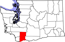
Website: www.skamaniacounty.org

Skamania County ist ein County im US-Bundesstaat Washington. Hier leben 9872 Einwohner. Der Sitz der Countyverwaltung (County Seat) ist in Stevenson. Zum County gehört das Carson River Valley.

Inhaltsverzeichnis

Geographie

Mount St. Helens

Im County liegt der Vulkan Mount St. Helens, der bekannteste Vulkan in den Vereinigte Staaten. Er ist seit dem 18. Mai 1980 2.549 m hoch. Vorher betrug seine Höhe 2.950 m.

Fläche

Das County hat eine Fläche von 4361 km², davon sind 4290 km² Land und 71 km² (1,63 %) Wasserfläche.

Weblinks


Wikimedia Foundation.

Игры ⚽ Поможем написать курсовую

Schlagen Sie auch in anderen Wörterbüchern nach:

  • Skamania County, Washington — Location in the state of Washington …   Wikipedia

  • Silver Star Mountain (Skamania County, Washington) — Infobox Mountain Name = Silver Star Mountain Photo = SILVERSTARSUMMIT.jpg Caption = Summit of Silver Star with Mount St. Helens in the background Elevation = convert|1338|m|ft|0|lk=on Prominence = Location = Skamania County, Washington Range =… …   Wikipedia

  • Clark County, Washington — Location in the state of Washington …   Wikipedia

  • Cowlitz County, Washington — Location in the state of Washington …   Wikipedia

  • Yakima County, Washington — Infobox U.S. County county = Yakima County state = Washington map size = 225 founded = January 21, 1865 seat = Yakima | area total sq mi =4312 area land sq mi =4296 area water sq mi =15 area percentage = 0.63% census yr = 2000 pop = 222581… …   Wikipedia

  • Lewis County, Washington — Infobox U.S. County county = Lewis County state = Washington map size = 225 founded = December 19, 1845 seat = Chehalis | area total sq mi =2436 area land sq mi =2408 area water sq mi =29 area percentage = 1.18% census yr = 2000 pop = 68600… …   Wikipedia

  • Klickitat County, Washington — Infobox U.S. County county = Klickitat County state = Washington map size = 225 founded = December 20, 1859 seat = Goldendale | area total sq mi =1904 area land sq mi =1872 area water sq mi =32 area percentage = 1.67% pop as of = 2006 pop =… …   Wikipedia

  • Skamania County — Verwaltung US Bundesstaat: Washington Verwaltungssitz: Stevenson Gründung: 1854 Demographie Einwohner: 9872  (2000) …   Deutsch Wikipedia

  • Island County (Washington) — Verwaltung US Bundesstaat: Washington Verwaltungssitz: Coupeville Adresse des Verwaltungssitzes: Gründung: 1 …   Deutsch Wikipedia

  • Kittitas County (Washington) — Verwaltung US Bundesstaat: Washington Verwaltungssitz: Ellensburg Adresse des Verwaltungssitzes: Gründung …   Deutsch Wikipedia

Share the article and excerpts

Direct link
Do a right-click on the link above
and select “Copy Link”