- Tavastkyro
-
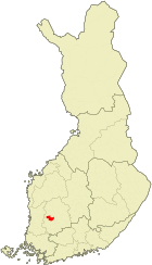
Hämeenkyrön kunta Wappen Karte 
Basisdaten Staat: Finnland Provinz: Westfinnland Landschaft: Pirkanmaa Verwaltungsgemeinschaft: Nordwestpirkanmaa Geographische Lage 61° 38′ N, 23° 12′ O61.63333333333323.2Koordinaten: 61° 38′ N, 23° 12′ O Höhe: Fläche: 505,13 km²
davon Land: 463,70 km²Einwohner: 10.215 (31. Aug. 2006) Bevölkerungsdichte: 21,98 Einwohner je km² Sprache(n): Finnisch Website: hameenkyro.fi Hämeenkyrö (schwed. Tavastkyro) ist eine finnische Gemeinde in der Landschaft Pirkanmaa in der Provinz Westfinnland.
Inhaltsverzeichnis
Dörfer
Haukijärvi, Heinijärvi, Herttuala, Hiironen, Hirvola, Ilottula, Jumesniemi, Järvenkylä, Kalkunmäki, Kierikkala, Komi, Kostula, Kuotila, Kyröspohja, Laitila, Lavajärvi, Lemmakkala, Mahnala, Muotiala, Myllymäki, Palko, Pappila, Parila, Pentinmaa, Pinsiö, Pukara, Pyöräniemi, Räystö, Sarkkila, Sasi, Sirkkala, Timi, Tokoinen, Tuokkola, Turkkila, Untila, Urjainen, Uskela, Vanaja, Vesajärvi, Äkönmaa
Städtepartnerschaften
Hämeenkyrö unterhält folgende Städtepartnerschaften:
Bekannte Söhne und Töchter
- Yrjö Sakari Yrjö-Koskinen, Politiker
- Frans Eemil Sillanpää, Schriftsteller
- Arvo Tuominen, Politiker
- Paavo Yrjölä, Leichtathlet
- Jussi Selo, Sänger der Band Uniklubi, sowie alle anderen Mitglieder der Band mit Ausnahme des aus Ikaalinen stammenden Bassisten
Weblinks
 Städte und Gemeinden in Pirkanmaa
Akaa | Hämeenkyrö | Ikaalinen | Juupajoki | Kangasala | Kihniö | Kuhmalahti | Kylmäkoski | Lempäälä | Mänttä-Vilppula | Nokia | Orivesi | Pälkäne | Parkano | Pirkkala | Punkalaidun | Ruovesi | Sastamala | Tampere | Urjala | Valkeakoski | Vesilahti | Virrat | Ylöjärvi


Wikimedia Foundation.