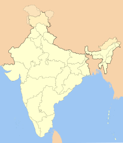
Thiruvallur

Thiruvallur
Tiruvallur
Tiruvallur (Indien)
DEC
Staat: Indien
Bundesstaat: Tamil Nadu
Distrikt: Tiruvallur
Lage: 13° 9′ N, 79° 55′ O13.1579.917Koordinaten: 13° 9′ N, 79° 55′ O
Einwohner: 45.517 (2001)[1]p1

Tiruvallur (auch: Thiruvallur oder veraltet Trivellore; Tamil: திருவள்ளூர், Tiruvaḷḷūr; [ˈtirɯʋaɭːuːɾ]) ist eine Stadt im südindischen Bundesstaat Tamil Nadu. Sie liegt im Norden Tamil Nadus rund 40 Kilometer nordwestlich von Chennai, der Hauptstadt des Bundesstaats. Tiruvallur ist Verwaltungssitz des gleichnamigen Distrikts. Bei der Volkszählung 2001 wurden in Tiruvallur 45.517 Einwohner registriert.[2]

Tiruvallur gehört zu den 108 heiligen Orten des Vishnuismus. In der Stadt befinden sich vier große Tempel, von denen drei Vishnu und einer Shiva geweiht sind. Der wichtigste Tempel ist der Viraraghavaswami-Tempel.

Weblinks

Einzelnachweise

  1. Census of India 2001: Population, population in the age group 0-6 and literates by sex - Cities/Towns (in alphabetic order)
  2. Census of India 2001: Data from the 2001 Census, including cities, villages and towns. (Provisional)

Wikimedia Foundation.

Игры ⚽ Нужно решить контрольную?

Schlagen Sie auch in anderen Wörterbüchern nach:

  • Thiruvallur — Admin ASC 2 Code Orig. name Thiruvallur Country and Admin Code IN.25.7627241 IN …   World countries Adminstrative division ASC I-II

  • District de Thiruvallur — திருவள்ளூர் மாவட்டம் (District de Thiruvallur) Localisation dans l état Administration Pays …   Wikipédia en Français

  • Narasingapuram, Thiruvallur — Narasingapuram (நரசிங்கபுரம்) village located about 55 km from Chennai, while travelling from Chennai to Sriperumbudur on the National Highway. Have to take a right turn near Empee Distillers and travel through the road to reach this village …   Wikipedia

  • Thiruevvul — Thiruvallur Temple is also called Thiruevvul near Arakkonam, Tamil Nadu. The deity here is Lord Veeraraghava Perumal with his consort Kanakavalli Thayaar. It is one of the 108 Divya desam. The Lord here is in reclining posture on Sesha facing… …   Wikipedia

  • Highways of Tamil Nadu — Map indicating Highways network of Tamil Nadu In Tamil Nadu, a separate Highways Department (HD) was established on April, 1946 and the same has been renamed as Highways Minor Ports Department (HMPD) on 30 October 2008.[1] HMPD of Tamil Nadu is… …   Wikipedia

  • Thiruninravur — Infobox Indian Jurisdiction native name = Thirunindravur | type = suburb | metro=Chennai latd = 13.1236| longd = 80.0279 state name = Tamil Nadu district = Thiruvallur leader title = leader name = altitude = population as of = 2001 population… …   Wikipedia

  • Tiruvallur district — is an administrative district in the South Indian state of Tamil Nadu. The town of Thiruvallur is the district headquarters.GeographyIt is bounded on the north by Andhra Pradesh state, on the east by the Bay of Bengal, on the southwest by Chennai …   Wikipedia

  • Sengunthar — Tamil: செங்குந்தர் Castes of India Race Dravidian race Ti …   Wikipedia

  • Chennai Metropolitan Area — Districts and Taluks of the metropolitan area The CMDA …   Wikipedia

  • Porur — Infobox Indian Jurisdiction native name = PORUR | type = suburb | metro=Chennai latd = 13.03478 | longd = 80.15586 locator position = right | state name = Tamil Nadu district = Thiruvallur leader title = leader name = altitude = 16 population as… …   Wikipedia

Share the article and excerpts

Direct link
Do a right-click on the link above
and select “Copy Link”