- Tweed Shire
-
Shire of Tweed 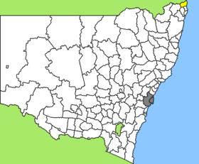
Lage des Tweed Shire in New South WalesGliederung Staat:  Australien
Bundesstaat:  New South Wales
Verwaltungssitz: Murwillumbah Daten und Zahlen Fläche: 1.309 km² Einwohner: 79.321 (2006) [1] Bevölkerungsdichte: 61 Einwohner je km² -28.333333333333153.4Koordinaten: 28° 20′ S, 153° 24′ OTweed Shire ist ein lokales Verwaltungsgebiet (LGA) im australischen Bundesstaat New South Wales. Das Gebiet ist 1.309 km² groß und hat etwa 83.000 Einwohner.
Tweed liegt im äußersten Nordosten des Staates an der Pazifikküste und der Grenze zu Queensland etwa 130 km südöstlich der Metropole Brisbane und 820 km nordöstlich von Sydney. Das Gebiet umfasst 120 Ortsteile und Ortschaften, darunter Banora Point, Bogangar, Burringbar, Chillingham, Condong, Eungella, Fingal Head, Hastings Point, Kunghur, Mooball, Murwillumbah, Pottsville Beach, Tumbulgum, Tweed Heads, Tyalgum, Uki, sowie Teile von Bilambil, Kingscliff und Terranora. Der Sitz des Shire Councils befindet sich in der Stadt Murwillumbah im Zentrum der LGA, wo etwa 8.000 Einwohner leben.
Inhaltsverzeichnis
Besonderes
Nordwestlich des Ortes Murwillumbah liegt auf einer alten Farm das Dschungel-Camp von RTL. Das Gelände auf einer Farm wurde zu einer Dschungelkulisse umgebaut und auch die Tiere wurden eigens dort hingebracht. Der Drehort, der nur etwa 30 km entfernt ist von Queenslands Gold Coast, diente auch als Schauplatz für das englische Original der Reality-Show.
Verwaltung
Bis Mai 2005 hatte der Tweed Shire Council elf Mitglieder, die von den Bewohnern der LGA gewählt wurden. Tweed ist nicht in Bezirke untergliedert. Aus dem Kreis der Councillor rekrutierte sich auch der Mayor (Bürgermeister) des Councils.
Wegen Korruptionsvorwürfen hat die Staatsregierung 2005 den Council aufgelöst und zwei Administratoren sowie ein fünfköpfiges Senior Management zur Führung der Geschäfte bis zu den nächsten Wahlen im September 2008 eingesetzt.
Weblinks
Einzelnachweise
- ↑ Australian Bureau of Statistics (25. Oktober 2007): Tweed (A) (Local Government Area) (Englisch). 2006 Census QuickStats. Abgerufen am 6. April 2010.
Kategorie:- Local Government Area in New South Wales

Wikimedia Foundation.