- Washington County (Utah)
-

Verwaltung US-Bundesstaat: Utah Verwaltungssitz: St.George Gründung: 1852 Demographie Einwohner: 138.115 (2010) Bevölkerungsdichte: 22 Einwohner/km² Geographie Fläche gesamt: 6.293 km² Wasserfläche: 8 km² Karte 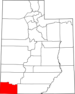
Website: www.co.washington.ut.us Washington County[2] ist ein County im Bundesstaat Utah der Vereinigten Staaten von Amerika. Der Sitz der Countyverwaltung (County Seat) ist St. George.
Inhaltsverzeichnis
Geografie
Das Washington County eine Fläche von 6293 Quadratkilometern, davon sind 8 Quadratkilometer Wasserfläche. Es grenzt im Uhrzeigersinn an die Countys: Iron County, Kane County, Mohave County (Arizona) und Lincoln County (Nevada). Im östlichen Teil des Countys liegt ein Teil des Zion-Nationalparks.
Geschichte
Washington County wurde im Jahre 1852 gegründet. Es hat seinen Namen nach dem ersten Präsidenten der Vereinigten Staaten, George Washington, erhalten.
Demografische Daten
Historische Einwohnerzahlen Census Einwohner ± in % 1860 691 — 1870 3064 300 % 1880 4235 40 % 1890 4009 -5 % 1900 4612 20 % 1910 5123 10 % 1920 6764 30 % 1930 7420 10 % 1940 9269 20 % 1950 9836 6 % 1960 10.271 4 % 1970 13.669 30 % 1980 26.065 90 % 1990 48.560 90 % 2000 90.354 90 % 2010 138.115 50 % Vor 1900[3]  Alterspyramide des Countys (Stand: 2000)
 Washington County (UT), Details
 Straße zum Zion-Nationalpark
 Mormonentempel in St. George, ältester noch heute in Betrieb befindlicher Tempel der Heiligen der Letzten Tage, gelistet unter St. George Temple im NRHP mit der Nr. 77001325[6]
Nach der Volkszählung im Jahr 2000 lebten im Washington County 90.354 Menschen. Es gab 29.939 Haushalte und 23.442 Familien. Die Bevölkerungsdichte betrug 14 Einwohner pro Quadratkilometer. Ethnisch betrachtet setzte sich die Bevölkerung zusammen aus 93,57% Weißen, 0,21% Afroamerikanern, 1,47% amerikanischen Ureinwohnern, 0,45% Asiaten, 0,42% Bewohnern aus dem pazifischen Inselraum und 2,24% aus anderen ethnischen Gruppen; 1,65% stammten von zwei oder mehr ethnischen Gruppen ab. 5,23% der Bevölkerung waren spanischer oder lateinamerikanischer Abstammung.
Von den 29.939 Haushalten hatten 37,10% Kinder und Jugendliche unter 18 Jahre, die bei ihnen lebten. 67,60% waren verheiratete, zusammenlebende Paare, 8,00% waren allein erziehende Mütter. 21,70% waren keine Familien. 17,50% waren Singlehaushalte und in 8,90% lebten Menschen im Alter von 65 Jahren oder darüber. Die Durchschnittshaushaltsgröße betrug 2,97 und die durchschnittliche Familiengröße lag bei 3,36 Personen.
Auf das gesamte County bezogen setzte sich die Bevölkerung zusammen aus 31,20% Einwohnern unter 18 Jahren, 11,60% zwischen 18 und 24 Jahren, 22,40% zwischen 25 und 44 Jahren, 17,80% zwischen 45 und 64 Jahren und 17,00% waren 65 Jahre alt oder darüber. Das Durchschnittsalter betrug 31 Jahre. Auf 100 weibliche Personen kamen 97,30 männliche Personen, auf 100 Frauen im Alter ab 18 Jahren kamen statistisch 94,40 Männer.
Das jährliche Durchschnittseinkommen eines Haushalts betrug 37.212 USD, das Durchschnittseinkommen der Familien betrug 41.845 USD. Männer hatten ein Durchschnittseinkommen von 31.275 USD, Frauen 20.856 USD. Das Prokopfeinkommen betrug 15.873 USD. 11,20% der Bevölkerung und 7,70% der Familien lebten unterhalb der Armutsgrenze. 14,60% davon waren unter 18 Jahre und 4,20% waren 65 Jahre oder älter.
Seit der Volkszählung des Jahres 1970 hat sich die Bevölkerung des Counties gut verzehnfacht.
Städte und Orte
- Anderson Junction
- Apple Valley
- Atkinville
- Big Plain Junction
- Bloomington
- Central
- Dammeron Valley
- Enterprise
- Gunlock
- Harrisburg
- Harrisburg Junction
- Hildale
- Hurricane
- Ivins
- LaVerkin
- Leeds
- Middleton
- Motoqua
- New Harmony
- Pine Valley
- Pintura
- Rockville
- Saint George
- Santa Clara
- Shem
- Shivwits
- Shunesburg
- Springdale
- Toquerville
- Veyo
- Virgin
- Washington
- Zion Lodge
Geisterstädte
Duncan's Retreat | Grafton | Hebron | Silver Reef
Einzelnachweise
- ↑ Auszug aus dem National Register of Historic Places. Abgerufen am 13. März 2011
- ↑ Washington County im Geographic Names Information System des United States Geological Survey. Abgerufen am 22. Februar 2011
- ↑ U.S. Census Bureau _ Census of Population and Housing. Abgerufen am 28. Februar 2011
- ↑ Auszug aus Census.gov. Abgerufen am 28. Februar 2011
- ↑ Auszug aus factfinder.census.gov Abgerufen am 28. Februar 2011
- ↑ Auszug aus dem National Register of Historic Places. Abgerufen am 13. März 2011
Weblinks
 Commons: Washington County – Sammlung von Bildern, Videos und Audiodateien
- Website
- Virtuelle Tour durch Washington County (englisch)

Liste der Countys in Utah
Beaver | Box Elder | Cache | Carbon | Daggett | Davis | Duchesne | Emery | Garfield | Grand | Iron | Juab | Kane | Millard | Morgan | Piute | Rich | Salt Lake | San Juan | Sanpete | Sevier | Summit | Tooele | Uintah | Utah | Wasatch | Washington | Wayne | Weber
Wikimedia Foundation.
Schlagen Sie auch in anderen Wörterbüchern nach:
Washington County, Utah — Infobox U.S. County county = Washington County state = Utah seallink = map size = 180 founded year = 1852 seat wl = St. George largest city wl = St. George area total sq mi = 2430 area total km2 = 6293 area land sq mi = 2427 area land km2 = 6285… … Wikipedia
National Register of Historic Places listings in Washington County, Utah — Location of Washington County in Utah This is a list of the National Register of Historic Places listings in Washington County, Utah. This is intended to be a complete list of the properties and districts on the National Register of Historic… … Wikipedia
Washington County School District (Utah) — Washington County School District is a school district headquartered in St. George, Utah, with 24,297 students enrolled as of October 2006. The district serves students in Washington County, Utah.Washington County School District administrative… … Wikipedia
Washington County Sheriff's Office — could refer to several sheriffs departments in the United States including:*Washington County, Alabama Sheriff s Office *Washington County, Arkansas Sheriff s Department *Washington County, Colorado Sheriff s Office *Washington County, Florida… … Wikipedia
Washington County — heißen: Washington County (Alabama) Washington County (Arkansas) Washington County (Colorado) Washington County (Florida) Washington County (Georgia) Washington County (Idaho) Washington County (Illinois) Washington County (Indiana) Washington… … Deutsch Wikipedia
Washington County — See also: List of counties in Washington for counties in the state of Washington. Washington County is the name of 30 counties and one parish in the United States of America: Contents 1 Extant counties 2 Extinct counties 3 Other … Wikipedia
Washington Terrace, Utah — for the St. Louis Missouri residential street, see Washington Terrace (St. Louis)Infobox Settlement official name = Washington Terrace, Utah settlement type = City nickname = motto = imagesize = image caption = image mapsize = 250px map caption … Wikipedia
Washington County Courthouse — bezeichnet mehrere gleichnamige, im NRHP gelistete, Objekte: Washington County Courthouse (Alabama), ID Nr. 97000655 Washington County Courthouse (Arkansas), ID Nr. 72000212 Washington County Courthouse (Georgia), ID Nr. 80001260 Washington… … Deutsch Wikipedia
Washington County Courthouse — may refer to one of these United States courthouses:* Washington County Courthouse (Alabama) * Washington County Courthouse (Arkansas) * Washington County Courthouse (Florida) * Washington County Courthouse (Georgia) * Washington County… … Wikipedia
Washington County School District — is a name shared by several school districts in the Washington County School District.* Washington County School District (Florida) (see List of county school districts in Florida) * Washington County School District (Utah) (see List of school… … Wikipedia
Washington County (Utah)


18+
© Academic, 2000-2024
- Kontaktieren Sie uns: Unterstützung, Werbung
Wörterbücher Export, schritte mit PHP, Joomla, Drupal, WordPress, MODx.