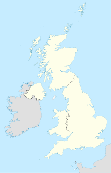
West Byfleet

West Byfleet
51.339166666667-0.49333333333334
West Byfleet (Vereinigtes Königreich)
West Byfleet
West Byfleet

West Byfleet ist eine Stadt in der britischen Grafschaft Surrey. Sie liegt westlich des Motorway M25 und besitzt einen eigenen Bahnhof der sich zwischen den Gemeinden Woking und Byfleet befindet.

Die Stadt besitzt eine Vielzahl von Restaurants welche von Thailändischer, Chinesischer, Indischer bis hin zur Italienischen Küche reichen. Der Grund hierfür ist, weil der Ort ein Anziehungspunkt für Einwohner aus den wohlhabenden Nachbargemeinden wie Pyrford, New Haw, Woodham, Byfleet und Ripley ist. West Byfleet hat derzeit etwa 5.054[1] Einwohner. Außerdem ist West Byfleet eine typische Pendlerstadt, da die meisten Erwerbstätigen der Stadt in London arbeiten.

Quellenangaben

  1. Population Data

Weblinks

 Commons: West Byfleet – Sammlung von Bildern, Videos und Audiodateien

Wikimedia Foundation.

Игры ⚽ Нужна курсовая?

Schlagen Sie auch in anderen Wörterbüchern nach:

  • West Byfleet — infobox UK place country = England official name= West Byfleet map type= Surrey population = 5,054 [ [http://www.woking.gov.uk/woking/population/westbyfleet.pdf Population Data] ] shire district= Woking shire county = Surrey region= South East… …   Wikipedia

  • West Byfleet — Original name in latin West Byfleet Name in other language West Byfleet State code GB Continent/City Europe/London longitude 51.33946 latitude 0.49338 altitude 23 Population 5054 Date 2012 03 29 …   Cities with a population over 1000 database

  • West Byfleet railway station — Infobox UK station name = West Byfleet manager = South West Trains locale = West Byfleet borough = Woking code = WBY platforms = 3 latitude = 51.3395 longitude = 0.5054 start = 1 December 1887 usage0405 = 0.897 usage0506 = 0.910West Byfleet… …   Wikipedia

  • Byfleet — infobox UK place country= England official name= Byfleet map type= Surrey latitude = 51.38 longitude = 0.3526 population= 6,995 [ [http://www.surreycc.gov.uk/sccwebsite/sccwspublications.nsf/591f7dda55aad72a80256c670041a50d/1c602ea59c869c9180256e6… …   Wikipedia

  • Byfleet and New Haw railway station — Infobox UK station name = Byfleet and New Haw code = BFN manager = South West Trains locale = Byfleet borough = Runnymede usage0405 = 0.300 usage0506 = 0.283 usage0607 = 0.321 platforms = 2 start = 10 July 1927 latitude = 51.3497 longitude =… …   Wikipedia

  • Arriva Guildford & West Surrey — is a bus operator based in Guildford, England, part of the Arriva group. The company operates services in West Sussex and Surrey, as part of the Arriva Southern Counties division. The company also has the Guildford Park and Ride… …   Wikipedia

  • New Haw — Coordinates: 51°21′29″N 0°29′20″W / 51.358°N 0.4888°W / 51.358; 0.4888 …   Wikipedia

  • Christopher Landon — For the American screenwriter and son of actor Michael Landon, see Christopher B. Landon. Christopher Landon Born March 29, 1911(1911 03 29) West Byfleet, Surrey Died April 26, 1961(1961 04 26) (aged 50) Frognal …   Wikipedia

  • Cobham, Surrey — Not to be confused with Chobham, Surrey or Cobham, Kent. Coordinates: 51°19′44″N 0°24′34″W / 51.3289°N 0.4094°W / …   Wikipedia

  • KT postcode area — Infobox UK postcode area|area code=KT source=Statistics as at October 2006 [National Statistics, [http://www.statistics.gov.uk/geography/downloads/NSPDVersionNotes.pdf Postcode Directory Version Notes] , (2006)] | Location map+|Greater London… …   Wikipedia

Share the article and excerpts

Direct link
Do a right-click on the link above
and select “Copy Link”