- Ynys Mon
-
Anglesey Principal Area 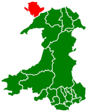
Verwaltungssitz Llangefni Fläche 714 km² Einwohner (2006) 68.900 Walisischsprachige 70,4 % ISO 3166-2 GB-AGY ONS-Code 00NA Website www.anglesey.gov.uk  Bryn celli ddu Innenansicht
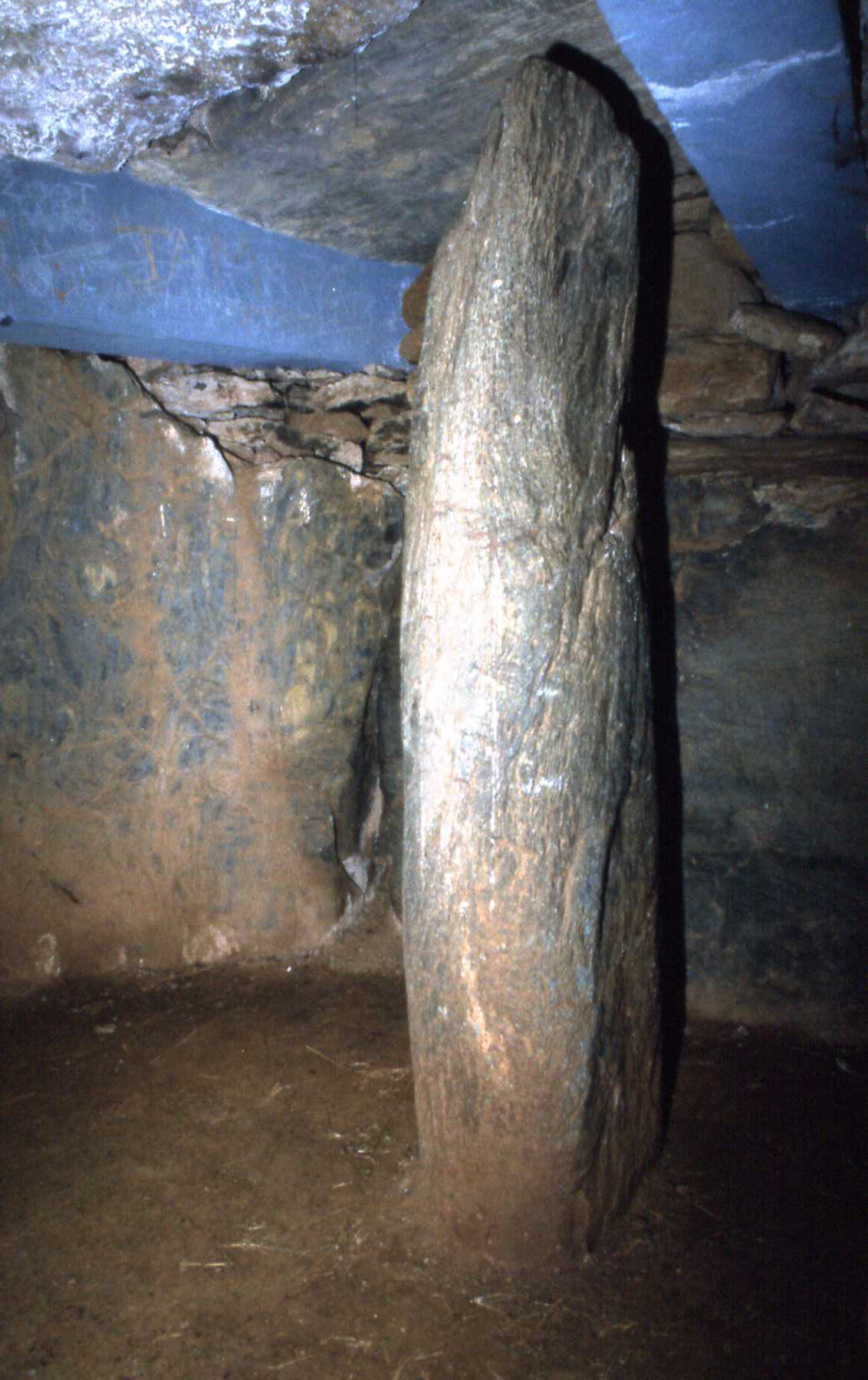
 Bryn celli ddu
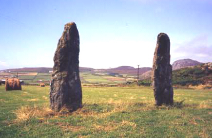
 Penrhos Feiwl
Anglesey (englisch für Insel der Angeln, walisisch Ynys Môn; auch Anglesea, Mona) ist eine Insel vor der Nordwestküste von Wales in der Irischen See und eine gleichnamige Grafschaft. Verwaltungssitz ist Llangefni, größte Stadt ist jedoch der Fährhafen Holyhead. Die Landschaft ist von Hügeln geprägt. Vorwiegend werden Rinder und Schweine gezüchtet.
Über die Menaistraße führen zwei Brücken, welche die Insel mit Wales verbinden. Vom Hafen Holyhead verkehren Fähren nach Dublin (u. a. die M/S Ulysses, eine der größten Fähren der Welt), und Dun Laoghaire in der Republik Irland.
Geschichte
Am Ende der Vorzeit war Anglesey ein Zentrum der Druiden, weshalb sie "Insel der Druiden" genannt wurde. Im Jahre 61 n. Chr. zerstörten die Römer unter Gaius Suetonius Paulinus das dortige Heiligtum, um den anhaltenden, durch die Priesterschaft geförderten Widerstand der keltischen Bevölkerung zu brechen. Sie nannten die Insel Mona, wie sie auch früher genannt worden war. Die Engländer fügten Anglesey im 13. Jahrhundert ihrem Königreich hinzu. Die Pagan-Metal Band Eluveitie schrieb ein Lied (Inis Mona) über die Insel und die Druiden.
Sehenswürdigkeiten
Unter den erhaltenen ragen die Megalithanlagen von Barclodiad-y-Gawres (eine Anlage des Maes Howe bzw. Newgrange Typs), Plas Newydd, Trefignath und die restaurierte Anlage von Bryn Celli Ddu heraus. Die beiden etwa 3 m hohen nadelartigen Menhire von Penrhos Feiwl sind zwei von 39 Menhiren auf der Insel.
Anglesey ist ein beliebtes Touristenziel. Auf der Insel befindet sich mit Llanfairpwllgwyngyllgogerychwyrndrobwllllantysiliogogogoch der Ort mit dem längsten Ortsnamen Europas. Anglesey ist als Area of Outstanding Natural Beauty klassifiziert.
Vor der Insel Anglesey ist eine Farm aus sieben Gezeitenkraftwerken in Planung, die voraussichtlich ab 2012 Elektrizität (etwa 10,5 Megawatt Leistung) produzieren soll.
Weblinks

Anglesey | Blaenau Gwent | Bridgend | Caerphilly | Cardiff | Carmarthenshire | Ceredigion | Conwy (County Borough) | Denbighshire | Flintshire | Gwynedd | Merthyr Tydfil | Monmouthshire | Neath Port Talbot | Newport | Pembrokeshire | Powys | Rhondda Cynon Taff | Swansea | Torfaen | Vale of Glamorgan | Wrexham
53.293975-4.3767277777778Koordinaten: 53° 18′ N, 4° 23′ W


Wikimedia Foundation.