Bet Jala

Bet Jala
Bait Dschala (Palästinensische Autonomiegebiete)
DMS
Bait Dschala
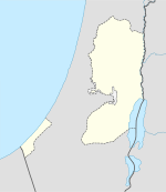
Bait Dschala
Bait Dschala auf der Karte der Palästinensischen Autonomiegebiete
2005: Blick von Gilo auf Bait Dschala mit einem Teil der israelischen Sicherheitsanlage

Bait Dschala (arabischبيت جالا‎, DMG Bait Ǧālā, hocharabisch Bait Dschālā, palästinensisch-arabisch Bēt Dschālā, auch als Beit Jala transkribiert; angeblich von aramäisch „Grasteppich“) ist eine kleine palästinensische Stadt 10 km südlich von Jerusalem auf der westlichen Seite der Hebronstraße gleich gegenüber Betlehem. Bait Dschala liegt auf etwa 970 m üNN und hat etwa 15.000 muslimische und christliche Einwohner. In Mittel- und Südamerika sollen etwa 70.000 vor allem christliche Personen leben, die von ehemaligen Bewohnern Beit Dschalas abstammen.

Wie in Betlehem, Jerusalem und anderen für Christen bedeutenden Orten im Heiligen Land befinden sich in Bait Dschala Schulen mehrerer Konfessionen, darunter eine 1870 gegründete russisch-orthodoxe Schule. Das Priesterseminar des Lateinischen Patriarchats Jerusalem wurde 1936 nach Bait Dschala verlegt.

Die lutherische Gemeinde Bait Dschala hat enge Kontakte zu deutschen Gemeinden. Die Schule Talitha Kumi wird von deutschen und palästinensischen Lutheranern betrieben. An Lifegate Rehabilitation, einer Rehabilitationswerkschaft für Körperbehinderte mit etwa 25 Mitarbeitern, sind Diakonie und Caritas beteiligt.

Weitere Gesundheitseinrichtungen im Ort sind die Arab Society for the Rehabilitation und ein Krankenhaus. 1400 ha Land werden bebaut, vor allem mit Oliven und Wein. Cremisan Cellars, im Kloster Cremisan gelegen, ist die größte Weinkellerei der Gegend.

Bait Dschalas Ortsbild wird von zwei Moscheen und sechs Kirchen bestimmt, darunter ist die Kirche der Jungfrau Maria die älteste und St. Nicholas die wichtigste (beide sind orthodox).

In den Blickpunkt der internationalen Nachrichten rückte Bait Dschala Ende des Jahres 2000, als palästinensische Extremisten von hier aus den Jerusalemer Stadtteil Gilo beschossen. Israel antwortete damals mit Luftangriffen und dem Bau einer massiven Betonmauer um Gilo.

Siehe auch: Liste der Städte in den palästinensischen Autonomiegebieten

Weblinks

31.71666666666735.1833333333337Koordinaten: 31° 43′ N, 35° 11′ O


Wikimedia Foundation.

Игры ⚽ Поможем написать реферат

Schlagen Sie auch in anderen Wörterbüchern nach:

  • BET(H)-CHEREM — (Heb. בֵּית הַכֶּרֶם, Bet ha Kerem, The House of the Vineyard ), settlement west of Jerusalem in the First and Second Temple periods. It is first mentioned at the time of the Judean kingdom in an appendix of the Septuagint to the list of Judean… …   Encyclopedia of Judaism

  • Beit Jala — Saltar a navegación, búsqueda Beit Jala (en árabe بيت جالا , pronunciado como Bet Yala ) es una ciudad de Cisjordania, una de las más antiguas de Palestina. Se localiza a 825 msnm sobre la ladera de un cerro cubierto de árboles de olivo (muchos… …   Wikipedia Español

  • Beit Jala — DMS …   Deutsch Wikipedia

  • Sami Aldeeb — in 2011 Sami Awad Aldeeb Abu Sahlieh, né le 5 septembre 1949 à Zababdeh, près de Jénin en Cis Jordanie, est un juriste chrétien, d origine palestinienne et de nationalité suisse[1]. Il a été le responsable du droit arabe et musulman à l Institut… …   Wikipédia en Français

  • RELIGIOUS LIFE AND COMMUNITIES — Jews UNDER OTTOMAN RULE The Jews of the pre Zionist old yishuv, both sephardim (from the Orient) and ashkenazim (of European origin), dedicated their lives to the fulfillment of religious precepts: the study of the torah and the meticulous… …   Encyclopedia of Judaism

  • Bait Dschala — بيت جالا Bait Dschala …   Deutsch Wikipedia

  • BETHLEHEM — (Beth Lehem) (Heb. בֵּית לֶחֶם; Arab. Bait Lahm), city in Judah located five mi. (eight km.) S. of Jerusalem. Bethlehem may be mentioned in the el amarna letters (14th century B.C.E.) as a city in the territory of Jerusalem (Bit ilu Nin. Ib = the …   Encyclopedia of Judaism

  • HUMAN GEOGRAPHY — In respect of human as well as of physical geography, it is convenient to divide the Land of Israel into four major units: 1. the Mediterranean Coastal Plain 2. the hill regions of northern and central Cisjordan (west of the Jordan) 3. the Rift… …   Encyclopedia of Judaism

  • Second Intifada — Part of the Israeli–Palestinian conflict and Arab–Israeli conflict Clockwise from above: A masked P …   Wikipedia

  • Beit Shemesh — Infobox Israel municipality name=Beit Shemesh caption=Emblem of Beit Shemesh imgsize=70 imgsize3=250 caption3=The modern city of Beit Shemesh, taken from Tel Beth Shemesh hebname=Hebrew|בֵּית שֶׁמֶשׁ arname= meaning=House of the sun founded= type …   Wikipedia

Share the article and excerpts

Direct link
Do a right-click on the link above
and select “Copy Link”