Bitterroot Valley

Bitterroot Valley
Verwaltung
US-Bundesstaat: Montana
Verwaltungssitz: Hamilton
Adresse des
Verwaltungssitzes:
Gründung: 1893
Gebildet aus:
Vorwahl: {{{VORWAHL}}}
Demographie
Einwohner: 36.070  (2000)
Bevölkerungsdichte: 5,8 Einwohner/km²
Geographie
Fläche gesamt: 6.217 km²
Wasserfläche: 16 km²
Karte
Karte von Ravalli County innerhalb von Montana
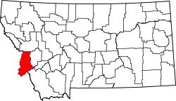
Website: www.co.ravalli.mt.us

Ravalli County ist ein County (Kreis) im US-Bundesstaat Montana. Seine Gesamtfläche beträgt 6.201 Quadratkilometer, der Sitz der Countyverwaltung (County Seat) ist Hamilton. Im gesamten County leben rund 36.100 Einwohner (2000).

Das County erstreckt sich über das Bitterroot Valley, durch das der Bitterroot River fließt.

Bevölkerungsentwicklung

Jahr Einwohnerzahlen
1900 7.800
1910 11.700
1920 10.100
1930 10.300
1940 13.000
1950 13.100
1960 12.300
1970 14.400
1980 22.500
1990 25.000
2000 36.100


46.08-114.127Koordinaten: 46° 5′ N, 114° 7′ W


Wikimedia Foundation.

Игры ⚽ Поможем написать реферат

Schlagen Sie auch in anderen Wörterbüchern nach:

  • Bitterroot Valley — The Bitterroot Valley is located in southwestern Montana in the northwestern United States. It extends over 100 miles (160 km) from remote Horse Creek Pass north to a point near the city of Missoula. To the west is the Bitterroot Range and the… …   Wikipedia

  • Bitterroot Range — Infobox protected area | name = Bitterroot Range caption = locator x = 60 locator y = 33 location = Idaho Montana USA nearest city = Missoula, MT lat degrees = 46 lat minutes = 00 lat seconds = 00 lat direction = N long degrees = 114 long minutes …   Wikipedia

  • Bitterroot — For the waterway, see Bitterroot River. Bitterroot Lewisia rediviva var. rediviva in Wenas Wildlife Area, Washington Scientific classification Kingdo …   Wikipedia

  • Bitterroot River — The Bitterroot River is a tributary of the Clark Fork River in southwestern Montana, USA. It runs for about 75 miles (121 km) south to north through the Bitterroot Valley, from the confluence of its West and East forks near Conner to the Clark… …   Wikipedia

  • Bitterroot Mountains — Trapper Peak in den Bitterroot Mountains Die Bitterroot Mountains sind ein Teil der größeren Bitterrootkette und liegen zwischen den US Bundesstaaten Idaho und Montana. Das Gebiet umfasst eine Fläche von 16.513 km² [1] und wird im… …   Deutsch Wikipedia

  • Bitterroot Mountains — Range Trapper Peak, in the Central Bitterroot Range …   Wikipedia

  • Montana Valley and Foothill grasslands — Region Montana in winter …   Wikipedia

  • Missoula, Montana — Missoula redirects here. For other uses, see Missoula (disambiguation). City of Missoula, Montana   City   Overlooking Downtown …   Wikipedia

  • Confederated Salish and Kootenai Tribes of the Flathead Nation — Flathead Indian redirects here. For the fish species, see Indian flathead. Flathead delegation in Washington, D.C. with interpreter, 1884 …   Wikipedia

  • Ravalli County, Montana — Infobox U.S. County county= Ravalli County state= Montana map size= 225 founded=1893 seat= Hamilton largest city= Hamilton leader= area total sq mi=2400 area land sq mi=2394 area water sq mi=6 area percentage= 0.25% census yr= 2000 pop= 36070… …   Wikipedia

Share the article and excerpts

Direct link
Do a right-click on the link above
and select “Copy Link”