- Amatignak Island
-
Amatignak Island Gewässer Pazifischer Ozean Inselgruppe Delarof Islands Geographische Lage 51° 15′ 44″ N, 179° 6′ 31″ W51.2622222-179.1086111302Koordinaten: 51° 15′ 44″ N, 179° 6′ 31″ W 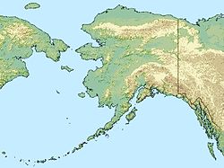

Länge 8 km Breite 4 km Höchste Erhebung 302 m Einwohner (unbewohnt) Amatignak Island ist eine kleine Insel der Delarof Islands, einer Inselgruppe im Westen der Andreanof Islands, die im Südwesten der Aleuten liegen. Die etwa 8 km lange und 302 m hohe Insel ist die südlichste der Aleuten. Die nächstgelegene Nachbarinsel Ulak Island liegt östlich in nur 6 km Entfernung.
Die andere Nachbarinsel Semisopochnoi befindet sich 80 km entfernt in westlicher Richtung.
Weblinks
Schlagen Sie auch in anderen Wörterbüchern nach:
Amatignak Island — Location map Alaska label= lat=51.459167 long= 183.108611 position=right width=250 float=right caption=Location in AlaskaAmatignak Island (Amatignax̂ [Bergsland, K Aleut Dictionary Fairbanks: Alaska Native Language Center, 1994] in Aleut) is a… … Wikipedia
Ulak Island — Vorlage:Infobox Insel/Wartung/Fläche fehltVorlage:Infobox Insel/Wartung/Höhe fehlt Ulak NASA Bild von Ulak Gewässer … Deutsch Wikipedia
Ulak Island — Location map Alaska label= lat=51.461535 long= 182.956985 position=right width=250 float=right caption=Location in AlaskaUlak Island (Yuulax̂ [Bergsland, K Aleut Dictionary Fairbanks: Alaska Native Language Center, 1994] in Aleut) is an island in … Wikipedia
Nunivak Island — Nunivak Maskette – Nunivak … Wikipedia
Medny Island — Map showing position of Commander Islands to the east of Kamchatka. The smaller island in the east is Medny and the larger island is Bering Island. Medny Island (also spelled Mednyy, Russian: остров Медный, sometimes called Copper Island in… … Wikipedia
Unalaska Island — Unalaska Native name: Nawan Alaxsxa[1] Map of the island … Wikipedia
Nelson Island (Alaska) — Nelson Native name: Qaluyaaq … Wikipedia
Chuginadak Island — Mount Cleveland erupts in 2006. Taken from the International Space Station Geography Location Aleutian Islands, Alaska, USA Coordinates … Wikipedia
Oglodak Island — Island … Wikipedia
Chagulak Island — Location in Alaska … Wikipedia
Amatignak Island

18+
© Academic, 2000-2024
- Kontaktieren Sie uns: Unterstützung, Werbung
Wörterbücher Export, schritte mit PHP, Joomla, Drupal, WordPress, MODx.