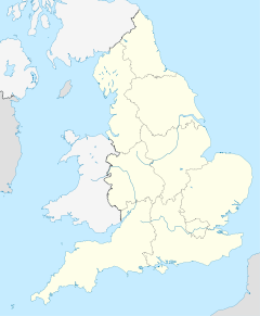
Beaminster — Saltar a navegación, búsqueda Parroquia de Beaminster. Beaminster es una localidad ubicada en Dorset, Inglaterra, sobre la ruta A3066, entre Bridport y Crewkerne. Se sitúa en el valle del río Brit. En 2001, tení … Wikipedia Español
Beaminster — (spr. Biminster), Stadt am Birton in einem fruchtbaren Thale der englischen Grafschaft Dorset; Segeltuchfabriken, Eisen u. Kupferwaarenfabrikation; 14,300 Ew … Pierer's Universal-Lexikon
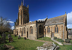
Beaminster — Infobox UK place official name= Beaminster local name= Beaminster country= England crown dependency = region= South West England region1= static static image caption= Beaminster Parish church area footnotes= area total sq mi= area total km2 =… … Wikipedia
Beaminster — Original name in latin Beaminster Name in other language State code GB Continent/City Europe/London longitude 50.809 latitude 2.7391 altitude 58 Population 2853 Date 2011 03 03 … Cities with a population over 1000 database
Beaminster Forum and Redhone (hundred) — Beaminster Forum Redhone Hundred was a hundred in the county of Dorset, England, containing the following parishes:*Beaminster *Bradpole *Chedington *Chardstock (transferred to Devon 1896) *Corscombe *Mapperton *Mosterton *Netherbury *North… … Wikipedia
Bridport — Infobox UK place official name= Bridport local name= shire district= West Dorset shire county= Dorset country= England region= South West England population= 12,977 os grid reference= SY464925 map type= Dorset latitude= 50.729 longitude= 2.758… … Wikipedia
List of schools in the South West of England — The following is a partial list of currently operating schools in the South West region of England. You may also find of use to find a particular school. See also the List of the oldest schools in the United Kingdom.Listed by local education… … Wikipedia
Damory Coaches — Ex Southern Vectis Leyland Olympian, 710 (TIL 6710), in the new Damory livery. Damory Coaches is a bus and coach operator based in Blandford Forum in Dorset, England. Officially registered as Hants Dorset Motor Services Limite … Wikipedia
Douglas John Wilson — The Rt Douglas John Wilson was an eminent Anglican Bishop in the mid 20th century [ Obituary Right Rev D. J. Wilson The Times Tuesday, Dec 02, 1980; pg. 14; Issue 60791; col G] . Born into an ecclesiastical family [His father was Canon J.K Wilson … Wikipedia
Sprat — Thomas Sprat Thomas Sprat (* 1635 in Beaminster, Dorset, England; † 20. Mai 1713 in Bromley, Kent) war ein englischer Autor und Bischof von Rochester 1684. Leben und Wirken Sprat war der Sohn des gleichnamigen Thomas Sprat, der Minister of… … Deutsch Wikipedia