- Besisahar
-
Besisahar 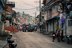
Basisdaten Land:  Nepal
NepalZone: Gandaki Distrikt: Lamjung Geografische Lage: 28° 6′ N, 84° 26′ O28.184.433333333333Koordinaten: 28° 6′ N, 84° 26′ O Zeitzone: UTC +5:45 Höhenlage: 780 m ü. NN Einwohnerzahl: Lage in Nepal 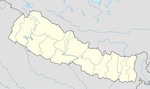

Besisahar Besisahar (manchmal auch Besi Sahar) ist der Hauptort des nepalesischen Distrikts Lamjung. In südlicher Richtung ist Besisahar über Dumre an den Prithvi Highway, die Hauptstraße zwischen Kathmandu und Pokhara, angebunden. Da die befestigte Straße in Besisahar endet, ist es ein wichtiger Ausgangspunkt für Treks auf dem Annapurna Circuit und der Manaslurunde.
-

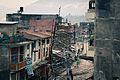
Besishahar - Blick von Gaunshahar.
-

Besishahar - Blick von Hiletaksar.
-
Kategorie:- Ort in Nepal
-


Wikimedia Foundation.