- Break O’Day Municipality
-
Municipality of Break O'Day 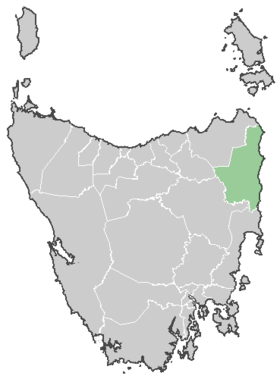
Lage der Break O'Day Municipality in TasmanienGliederung Staat:  Australien
Bundesstaat:  Tasmanien
Verwaltungssitz: St Helens Daten und Zahlen Fläche: 3.809 km² Einwohner: 6.071 (2006) [1] Bevölkerungsdichte: 1,6 Einwohner je km² -41.316666666667148.23333333333Koordinaten: 41° 19′ S, 148° 14′ ODie Break O'Day Municipality ist ein lokales Verwaltungsgebiet (LGA) im australischen Bundesstaat Tasmanien. Das Gebiet ist 3.809 km² groß und hat etwa 6.000 Einwohner.
Break O'Day liegt im Nordosten der Insel an der Küste und ist etwa 190 km von der Hauptstadt Hobart entfernt. Das Gebiet umfasst 29 Ortsteile und Ortschaften: Akaroa, Ansons Bay, Beaumaris, Binalong Bay, Chain of Lagoons, Cornwall, Eddystone, Falmouth, Four Mile Creek, Goshen, Goulds Country, Gray, Lottah, Mangana, Mathinna, Poimena, Pyengana, Round Hill, Scamander, Upper Scamander, Seymour, St Helens, Stieglitz, St Marys, Upper Esk, The Gardens, The Station, West Pyengana und Weldborough[2]. Der Sitz des Municipality Councils befindet sich in der Ortschaft St Helens im Osten der LGA an der Georges Bay, wo etwa 2000 Einwohner leben[3].
Verwaltung
Der Break O'Day Municipality Council hat neun Mitglieder. Der Mayor (Bürgermeister), sein Deputy (Stellvertreter) und sieben Councillor werden direkt von den Bewohnern der LGA gewählt. Break O'Day ist nicht in Bezirke untergliedert.
Quellen
- ↑ Australian Bureau of Statistics (25. Oktober 2007): Break O'Day (M) (Local Government Area) (Englisch). 2006 Census QuickStats. Abgerufen am 6. April 2010.
- ↑ Localities by Council, Local Government Association of Tasmania
- ↑ Australian Bureau of Statistics (25. Oktober 2007): St Helens (State Suburb)) (Englisch). 2006 Census QuickStats. Abgerufen am 6. April 2010.
Weblinks
Kategorie:- Local Government Area in Tasmanien

Wikimedia Foundation.