- Campo do Gerês
-
Campo do Gerês Wappen Karte 
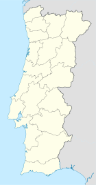

Basisdaten Region: Norte Unterregion: Cávado Distrikt: Braga Concelho: Terras de Bouro Koordinaten: 41° 46′ N, 8° 12′ W41.759153-8.195048Koordinaten: 41° 46′ N, 8° 12′ W Einwohner: 187 (Stand: 2001) Fläche: 68,8 km² Bevölkerungsdichte: 3 Einwohner pro km² Campo do Gerês ist eine Gemeinde im Norden Portugals.
Campo do Gerês gehört zum Kreis Terras de Bouro im Distrikt Braga, besitzt eine Fläche von 68.8 km² und hat 187 Einwohner (Stand: 2001).[1]
Siehe auch
Einzelnachweise
- ↑ Daten zu Campo do Gerês (en). alea.pt. Abgerufen am 21. Mai 2011.
Weblinks
- Karte der Freguesia Campo do Gerês beim Instituto Geográfico do Exército
- Information zu Campo do Gerês. cm-terrasdebouro.pt, abgerufen am 22. Mai 2011 (portugiesisch).
 Freguesias im Concelho Terras de Bouro
Balança | Brufe | Campo do Gerês | Carvalheira | Chamoim | Chorense | Cibões | Covide | Gondoriz | Moimenta | Monte | Ribeira | Rio Caldo | Souto | Valdosende | Vilar | Vilar da Veiga
Wikimedia Foundation.
Schlagen Sie auch in anderen Wörterbüchern nach:
Campo — bezeichnet in der italienischen, portugiesischen und spanischen Sprache ganz allgemein ein Feld oder einen Platz. Campo ist der Name folgender Ortschaften in der Schweiz eine Ortschaft im Bleniotal, Kanton Tessin: Campo (Blenio) eine Gemeinde im… … Deutsch Wikipedia
Casa D' Campo Ferreira — (Pitões das Júnias,Португалия) Категория отеля: Адрес: Rua de S.Gonçalo … Каталог отелей
RH Casas de Campo Design — (Parada,Португалия) Категория отеля: Адрес: Parada Lindoso, 4980 453 Par … Каталог отелей
Monuments of Portugal — The Monuments of Portugal were constructed throughout the Portuguese territory, and date back to the period of pre historic settlement of occupation. Subsequently, the region that is today Portugal has been colonized by many civilizations, which… … Wikipedia
Freguesias de Portugal — Anexo:Freguesias de Portugal Saltar a navegación, búsqueda Contenido 1 A 1.1 Abrantes 1.2 Águeda 1.3 … Wikipedia Español
Anexo:Freguesias de Portugal — Contenido 1 A 1.1 Abrantes 1.2 Águeda 1.3 Aguiar da Beira 1.4 … Wikipedia Español
Районы округа Брага — … Википедия
List of postal codes in Portugal — Aveiro districtMealhada municipality*3050 Antes *3050 Barcouço *3050 Casal Comba *3050 Luso *3050 Mealhada *3050 Pampilhosa *3050 Vacariça *3050 Ventosa do BairroMurtosa municipality*3870 Bunheiro *3870 Monte *3870 Murtosa *3870 TorreiraOliveira… … Wikipedia
Fronteras de España — Principales fronteras internacionales de España. España tiene un total de 2.032 km de fronteras con otros países, como consecuencia de su situación geográfica al suroeste del continente europeo, y rodeada del océano Atlántico y el mar… … Wikipedia Español
Кампу-ду-Жереш — Район Кампу ду Жереш Campo do Gerês Страна ПортугалияПортугалия … Википедия
Campo do Gerês


18+
© Academic, 2000-2024
- Kontaktieren Sie uns: Unterstützung, Werbung
Wörterbücher Export, schritte mit PHP, Joomla, Drupal, WordPress, MODx.