Cedar Bluff (Alabama)

Cedar Bluff (Alabama)
Cedar Bluff
Cherokee County Alabama Incorporated and Unincorporated areas Cedar Bluff Highlighted.svg
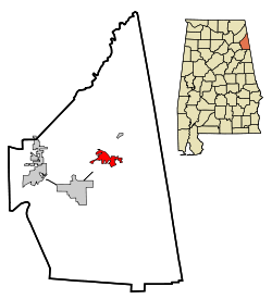
Lage im County und in Alabama
Basisdaten
Staat: Vereinigte Staaten
Bundesstaat: Alabama
County:

Cherokee County

Koordinaten: 34° 13′ N, 85° 36′ W34.220555555556-85.595833333333180Koordinaten: 34° 13′ N, 85° 36′ W
Zeitzone: Central Standard Time (UTC−6)
Einwohner: 1467 (Stand: 2000)
Bevölkerungsdichte: 142,4 Einwohner je km²
Fläche: 10,7 km² (ca. 4 mi²)
davon 10,3 km² (ca. 4 mi²) Land
Höhe: 180 m
Postleitzahl: 35959
Vorwahl: +1 256
FIPS: 01-12760
GNIS-ID: 0155014
Webpräsenz: www.cedarbluff-al.org

Cedar Bluff ist ein Ort im Cherokee County, Alabama, USA. Im Jahr 2000 hatte der Ort 1467 Einwohner. Im Gegensatz zum Rest des Countys ist in Cedar Bluff der Verkauf von Alkohol erlaubt. Der Ort hat eine Gesamtfläche von 10,7 km², davon sind 0,4 km² Wasserflächen.

Geschichte

Cedar Bluff wurde an der Kreuzung der Straßen nach Livingston und Centre gegründet. Östlich von Cedar Bluff fand im Sezessionskrieg eine Schlacht statt, in der der Konförderiertengeneral Nathan Bedforst Forest mit seiner Armee die von Abel Streight besiegte. Von 1837–1844 war Cedar Bluff Sitz der County-Verwaltung (County Seat).

Demographie

Nach der Volkszählung aus dem Jahr 2000 hatte Cedar Bluff 1467 Einwohner, die sich auf 830 Haushalte und 444 Familien verteilten. Die Bevölkerungsdichte betrug somit 94,8 Einwohner/km². 87,18% der Bevölkerung waren weiß, 11,38% afroamerikanisch. In 29,7% der Haushalte lebten Kinder unter 18 Jahren. Das Durchschnittseinkommen pro Haushalt betrug 29211 Dollar, wobei 21,1% der Einwohner unterhalb der Armutsgrenze lebten.

Quelle

Webseite des US Census Bureau


Wikimedia Foundation.

Игры ⚽ Поможем решить контрольную работу

Schlagen Sie auch in anderen Wörterbüchern nach:

  • Cedar Bluff, Alabama — Infobox Settlement official name = Cedar Bluff, Alabama settlement type = Town imagesize = image caption = image imagesize = image caption = image mapsize = 250px map caption = Location in Cherokee County and the state of Alabama mapsize1 = map… …   Wikipedia

  • Cedar Bluff — is the name of cities in the United States: *Cedar Bluff, Alabama *Cedar Bluff, Mississippi *Cedar Bluff, VirginiaThere is also: *Cedar Bluff Dam in the U.S. state of Kansas, which forms the Cedar Bluff Reservoir *Cedar Bluff Wildlife Area,… …   Wikipedia

  • Cedar Bluff — ist der Name mehrerer Orte in den Vereinigten Staaten: Cedar Bluff (Alabama) Cedar Bluff (Iowa) Cedar Bluff (Kentucky) Cedar Bluff (Michigan) Cedar Bluff (Mississippi) Cedar Bluff (Missouri) Cedar Bluff (Tennessee) Cedar Bluff (Virginia) …   Deutsch Wikipedia

  • Cedar Bluff — Cedar Bluff, AL U.S. town in Alabama Population (2000): 1467 Housing Units (2000): 975 Land area (2000): 3.971911 sq. miles (10.287201 sq. km) Water area (2000): 0.143186 sq. miles (0.370850 sq. km) Total area (2000): 4.115097 sq. miles… …   StarDict's U.S. Gazetteer Places

  • Cedar Bluff, AL — U.S. town in Alabama Population (2000): 1467 Housing Units (2000): 975 Land area (2000): 3.971911 sq. miles (10.287201 sq. km) Water area (2000): 0.143186 sq. miles (0.370850 sq. km) Total area (2000): 4.115097 sq. miles (10.658051 sq. km) FIPS… …   StarDict's U.S. Gazetteer Places

  • Cedar Bluff — Cedar Bluff, Postort in der Grafschaft Cherokee im Staate Alabama der Vereinigten Staaten von Nordamerika, am Coosa; in der Nähe Stromschnellen, Dampfschifffahrt nach denselben von Rome (Georgia) aus …   Pierer's Universal-Lexikon

  • Alabama locations by per capita income — Alabama has the thirty eighth highest per capita income in the United States of America, at $18,189 (2000). Its personal per capita income is $26,338 (2003), the fortieth highest in the country. Its median household income is $34,135 (2000),… …   Wikipedia

  • Alabama State Route 68 — Infobox road state=AL type=AL route=68 length mi=53 length ref= [ [http://colepages.com/routes5175.html Highway Route Info Routes 51 75 ] ] length round= established= direction a=West direction b=East starting terminus= junction= ending terminus …   Wikipedia

  • Alabama State Route 9 — Infobox road state=AL type=SR route=9 alternate name=U.S. Highway 331 (south of Montgomery) length mi=273.069 length ref=Alabama Department of Transportation, [http://www.dot.state.al.us/NR/rdonlyres/7B15B300 359D 413A A7FA… …   Wikipedia

  • Alabama State Route 35 — Infobox road state=AL type=AL route=35 length mi=50 length ref= [ [http://colepages.com/routes2650.html Highway Route Info Routes 26 50 ] ] length round= established=1940 direction a=South direction b=North starting terminus= junction= northwest… …   Wikipedia

Share the article and excerpts

Direct link
Do a right-click on the link above
and select “Copy Link”