Canarreos-Archipel — Cayo Largo ist die zweitgrößte Insel des Canarreos Archipel Gewässer Karibisches Meer … Deutsch Wikipedia
Canarreos Archipelago — Location map Cuba1 long = 82.2361111 lat = 21.6394444 Alternative caption = Location of Canarreos Archipelago in Cuba width = 280Canarreos Archipelago ( es. Archipiélago de los Canarreos) is an archipelago of Cuba. It is located south of the main … Wikipedia
Archipiélago de los Canarreos — Cayo Largo ist die zweitgrößte Insel des Canarreos Archipel Das Canarreos Archipel (span.: Archipiélago de los Canarreos) ist eine Inselgruppe am südlichen Festlandsockel Kubas, am Südende des Golf von Batabanó, entstanden aus Korallenriffen. Die … Deutsch Wikipedia
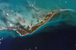
Archipiélago de los Canarreos — Saltar a navegación, búsqueda Vista satélital de Cayo Largo del Sur uno de los integrantes del Archipiélago de los Canarreos, Cuba El Archipiélago de los Canarreos es un grupo de islas del sur de Cuba. Localizadas en el … Wikipedia Español
Archipiélago de los Canarreos — Sp Kanarèoso salýnas Ap Archipiélago de los Canarreos L Karibų j., PV Kuba … Pasaulio vietovardžiai. Internetinė duomenų bazė
Cuba — This article is about the country. For other uses, see Cuba (disambiguation). Republic of Cuba República de Cuba … Wikipedia
Geography of Cuba — Cuba Nickname: La Isla Grande Map of Cuba Geography Location Caribbean Sea Coordinates … Wikipedia
Isla de la Juventud — Geobox Region name = Isla de la Juventud native name = other name = other name1 = category = image size = image caption = flag size = symbol = symbol size = country = CUB state = region = district = capital = Nueva Gerona capital type = Capital… … Wikipedia
Gulf of Batabanó — The Gulf of Batabanó (Spanish: Golfo de Batabanó ; pronounced bah tah bah NO ), also called the Batabanó Gulf, is an inlet or strait off southwestern Cuba in the Caribbean Sea, separating mainland Cuba from the Isle of Youth. It is located at… … Wikipedia
CU-99 — Isla de la Juventud Statistische Daten Hauptstadt: Nueva Gerona Fläche: 3.056 km² Einwohner: 100.000 … Deutsch Wikipedia
 Cayo Largo ist die zweitgrößte Insel des Canarreos Archipel