County Line (Alabama)

County Line (Alabama)
County Line
Blount County Alabama Incorporated and Unincorporated areas County Line Highlighted.svg
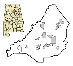
Lage im Jefferson County in Alabama
Basisdaten
Staat: Vereinigte Staaten
Bundesstaat: Alabama
Countys:

Blount County
Jefferson County

Koordinaten: 33° 49′ N, 86° 44′ W33.819722222222-86.729166666667169Koordinaten: 33° 49′ N, 86° 44′ W
Zeitzone: Central Standard Time (UTC−6)
Einwohner: 263 (Stand: 2006)
Bevölkerungsdichte: 105,2 Einwohner je km²
Fläche: 2,5 km² (ca. 1 mi²)
davon 2,5 km² (ca. 1 mi²) Land
Höhe: 169 m
FIPS: 01-17968
GNIS-ID: 0116712

County Line ist ein Ort im Blount County und im Jefferson County, Alabama in den Vereinigten Staaten. Die Gesamtfläche von County Line beträgt 2,5 km². 2006 hatte County Line nach einer Schätzung 263 Einwohner.

Demografie

Nach der Volkszählung aus dem Jahr 2000 hatte County Line 257 Einwohner, die sich auf 97 Haushalte und 73 Familien verteilten. 95,72 % der Bevölkerung waren weiß, 2,72 % afroamerikanisch. In 40,2 % der Haushalte lebten Kinder unter 18 Jahren. Das Durchschnittseinkommen betrug 25.625 US-Dollar pro Haushalt, wobei 17,4 % der Bevölkerung unterhalb der Armutsgrenze lebten.

Quelle


Wikimedia Foundation.

Игры ⚽ Нужно решить контрольную?

Schlagen Sie auch in anderen Wörterbüchern nach:

  • County Line, Alabama —   Town   Location in …   Wikipedia

  • County Line — ist der Name mehrerer Orte in den Vereinigten Staaten: County Line (Alabama) County Line (New York) County Line (Pennsylvania) County Line (Wisconsin) Diese Seite ist eine Begriffsklärung zur Unterscheidung mehrerer mit de …   Deutsch Wikipedia

  • County Line — may refer to: County Line, Alabama El Cerrito, Contra Costa County, California, formerly County Line This disambiguation page lists articles about distinct geographical locations with the same name. If an internal …   Wikipedia

  • County Line Baptist Church — U.S. National Register of Historic Places …   Wikipedia

  • County Line — County Line, AL U.S. town in Alabama Population (2000): 257 Housing Units (2000): 106 Land area (2000): 0.950075 sq. miles (2.460684 sq. km) Water area (2000): 0.000000 sq. miles (0.000000 sq. km) Total area (2000): 0.950075 sq. miles (2.460684… …   StarDict's U.S. Gazetteer Places

  • County Line, AL — U.S. town in Alabama Population (2000): 257 Housing Units (2000): 106 Land area (2000): 0.950075 sq. miles (2.460684 sq. km) Water area (2000): 0.000000 sq. miles (0.000000 sq. km) Total area (2000): 0.950075 sq. miles (2.460684 sq. km) FIPS code …   StarDict's U.S. Gazetteer Places

  • County Line Bowstring — U.S. National Register of Historic Places …   Wikipedia

  • Alabama locations by per capita income — Alabama has the thirty eighth highest per capita income in the United States of America, at $18,189 (2000). Its personal per capita income is $26,338 (2003), the fortieth highest in the country. Its median household income is $34,135 (2000),… …   Wikipedia

  • Alabama — This article is about the U.S. state of Alabama. For the river, see Alabama River. For other uses, see Alabama (disambiguation). State of Alabama …   Wikipedia

  • Alabama State Route 20 — Infobox road state=AL type=AL route=20 length mi=84 length ref= [ [http://colepages.com/routes125.html Highway Route Info Routes 1 25 ] ] length round= established= direction a=West direction b=East starting terminus= junction=Natchez Trace… …   Wikipedia

Share the article and excerpts

Direct link
Do a right-click on the link above
and select “Copy Link”