Cape Egmont — is the westernmost point of Taranaki, on the west coast of New Zealand s North Island. It is located close to the volcanic cone of Mount Taranaki or Mount Egmont.It was named Cabo Pieter Boreels by Dutch explorer Abel Tasman in 1642, but renamed… … Wikipedia
Cape Egmont Lighthouse — Infobox lighthouse|name= Cape Egmont Lighthouse [http://www.maritimenz.govt.nz/publications/lighthouses/capeegmont.pdf Cape Egmont Lighthouse Profile] (from the Maritime New Zealand website)] location= Cape Egmont, North Island, New Zealand… … Wikipedia
East Cape to Cape Egmont Traverse — This East Cape to Cape Egmont Traverse is not so much a trail, more a Kiwi pilgrimage to our early pioneers and landscape.Two authors/walkers have completed this traverse and written books: * * A H REED – From East Cape to Cape Egmont On Foot at… … Wikipedia
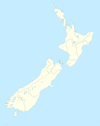
Egmont National Park — Infobox protected area name = Egmont National Park iucn category = II caption = Map of New Zealand locator x = 166 locator y = 75 location = Taranaki, New Zealand nearest city = New Plymouth, New Zealand lat degrees = 39 lat minutes = 16 lat… … Wikipedia
Cape Palliser — Lage des Cape Palliser Cape Palliser mit Leuchtturm. Cape Pallise … Deutsch Wikipedia
Egmont — /ˈɛgmɒnt/ (say egmont) noun 1. Mount, an extinct volcano in Egmont National Park in the south western part of the North Island of NZ. 2518 m. 2. Cape, a cape in the south western part of the North Island of NZ, west of Mount Egmont …
Egmont Cape — Sp Ègmonto kyšulỹs Ap Egmont Cape L Keip Bretono s. (N. Škotija), Princo Edvardo s., Kanada … Pasaulio vietovardžiai. Internetinė duomenų bazė
Kap Egmont — 39.279386111111173.75200277778 Koordinaten: 39° 16′ 46″ S, 173° 45′ 7″ O … Deutsch Wikipedia
Cabo Egmont — Saltar a navegación, búsqueda Capo Egmont es el punto mas occidental de Taranaki, en el oeste de Nueva Zelanda en la Isla Norte. Se ubica cerca de el cono volcánico del Monte Taranaki o Mount Egmont. Fue nombrado Cabo Pieter Boreels por el… … Wikipedia Español
Port Egmont — was the first British settlement in the Falkland Islands, on Saunders Island. HistoryPort Egmont was established in on 25 January 1765, by an expedition led by Commodore John Byron consisting of the boats Dolphin, Tamar and Florida. The… … Wikipedia