- Errochty Water
-
Errochty Water 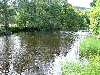
Errochty Water etwa in der Mitte des Flusslaufs
Daten Lage Perth and Kinross, Schottland Flusssystem Tay Abfluss über Garry (Tummel) → Tummel → Tay → Firth of Tay → Nordsee Flussgebietseinheit RBD Scotland Quellsee Loch Errochty
56° 45′ 51″ N, 4° 6′ 21″ W56.7641-4.1058Mündung bei Calvine in den Garry 56.765-3.949Koordinaten: 56° 45′ 54″ N, 3° 56′ 56″ W
56° 45′ 54″ N, 3° 56′ 56″ W56.765-3.949Länge 12 km Errochty Water ist ein Fluss im schottischen Hochland in der Unitary Authority Perth and Kinross.
Die Quelle des Errochty Water ist Loch Errochty. Der Fluss verlässt den See an dessen westlich gelegener Staumauer. Anschließend fließt Errochty Water weiter nach Westen, um nach circa 12 km bei Calvine in den Garry zu münden. Fast der gesamte Flusslauf liegt im Glen Errochty zwischen der B847 und dem Tay Forest Park.
 Brücke über Errochty Water
 Kategorien:
- Flusssystem Tay
- Fluss in Schottland
- Fluss in Europa
- Gewässer (Perth and Kinross)


Wikimedia Foundation.