Lake Sacajawea (See, Washington)

Lake Sacajawea (See, Washington)
Lake Sacajawea
LongviewSacajawea(Commons).jpg
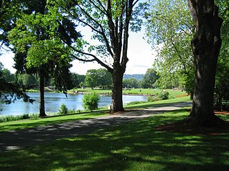
Geographische Lage Longview, Washington, USA
Zuflüsse vom Cowlitz River
Daten
Koordinaten 46° 8′ 6″ N, 122° 57′ 7″ W46.1351121-122.95205643Koordinaten: 46° 8′ 6″ N, 122° 57′ 7″ W
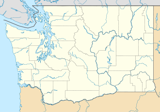
Lake Sacajawea (Washington)
Lake Sacajawea
Höhe über Meeresspiegel m
Fläche 24,7 haf5
Volumen 435.419 m³f8
Umfang 7,4 kmf9
Maximale Tiefe 6,4 mf10
Mittlere Tiefe 1,8 mf11
Einzugsgebiet 12,9 km²f4

Der Lake Sacajawea ist ein kleiner See im Zentrum von Longview im US-Bundesstaat Washington. Er liegt innerhalb des Lake Sacajawea Park und ist eingebunden zwischen dem Kessler Boulevard und dem Nichols Boulevard. Seine Fläche beträgt 24,7 Hektar und wird vom Cowlitz River gespeist. [1][2][3][4]

Weitere Daten des Sees sind: Einzugsgebiet 12,9 km², Durchschnittstiefe 1,8 Meter, Maximale Tiefe 6,4 Meter, Kapazitätvolumen 435.419 Kubikmeter, Uferlänge 7,4 Kilometer, Höhe über dem Meeresspiegel 3 Meter.[4]

Seit sieben Jahren wird an dem innerstädtischen See ein Angeltag für Kinder organisiert.[5]

Weitere Namen

Weitere Bezeichnungen des Sees sind:

  • Fowler Lake [6]
  • Fowler Slough [7]
  • Fowler’s Lake [8]
  • Horseshoe Lake [9]
  • Sacajawea Lake [10]

Weblinks

Einzelnachweise

  1. Lake Sacajawea (See, Washington) im Geographic Names Information System des United States Geological Survey
  2. Photo #12135 - Lake Sacajawea, Longview Bordered by Kessler Blvd on the east and Nichols Blvd. on the west. Lake Sacajawea, a 60 acre lake within a 60 acre park - located in a...
  3. City of Longview, Washington: Lake Sacajawea Park
  4. a b Sacajawea SACCO1 (PDF-Datei)
  5. WDFW FISHING RULE CHANGE: Martin's Dock at Lake Sacajawea will close to public for Kids Fish-In
  6. U.S. Geological Survey. Geographic Names Phase I data compilation (1976-1981). 31-Dec-1981. Primarily from U.S. Geological Survey 1:24,000-scale topographic maps (or 1:25K, Puerto Rico 1:20K) and from U.S. Board on Geographic Names files. In some instances, from 1:62,500 scale or 1:250,000 scale maps
  7. Miscellaneous Sources - A brief description and the year of publication (if known) follow: 1961/Lakes of WA
  8. Hitchman, Robert. Place Names of Washington. State Historical Society, 1985. ISBN 0-917048-57-1
  9. Hitchman, Robert. Place Names of Washington. State Historical Society, 1985. ISBN 0-917048-57-1
  10. Miscellaneous Sources - A brief description and the year of publication (if known) follow: 1961/Lakes of WA

Wikimedia Foundation.

Игры ⚽ Поможем сделать НИР

Schlagen Sie auch in anderen Wörterbüchern nach:

  • Sacajawea — Amerikanische 1 Dollar Münze mit dem Bild Sacajaweas …   Deutsch Wikipedia

  • Horseshoe Lake — ist der Name folgender Ortschaften: Horseshoe Lake (Arizona), eine Stadt im US Bundesstaat Arizona Horseshoe Lake (Arkansas), eine Stadt in Arkansas Horseshoe Lake ist der Name folgender Seen: Horseshoe Lake (Arizona), ein See im US Bundesstaat… …   Deutsch Wikipedia

  • Washington Natural Areas Program — The Washington Natural Areas Program, part of the Washington Department of Natural Resources, manages dozens of natural areas owned by the US state of Washington. These areas have received funding through the state s general fund since the… …   Wikipedia

  • National Register of Historic Places listings in Cowlitz County, Washington — List of entries on the National Register of Historic Places in Cowlitz County, Washington See also National Register of Historic Places listings in Washington This National Park Service list is complete through NPS recent listings posted November …   Wikipedia

  • National Register of Historic Places listings in Washington — AD AS BE CH CM …   Wikipedia

  • Vancouver, Washington — City of Vancouver[1]   City   A View of Downtown Vancouver from Jantzen Beach (Hayden Island) …   Wikipedia

  • Hazel Dell, Washington — Hazel Dell is an unincorporated area of Clark County, Washington located north and west of Vancouver, Washington, USA. The area runs parallel to and is bisected by Interstate 5. The community of Hazel Dell is bounded by Vancouver city limits on… …   Wikipedia

  • Liste der Seen der Vereinigten Staaten — Inhaltsverzeichnis 1 Seen nach Gewässerart 1.1 Süßwasserseen 1.2 Salz bzw. Brackwasserseen 1.3 Stauseen …   Deutsch Wikipedia

  • Conboy Lake National Wildlife Refuge — IUCN Category IV (Habitat/Species Management Area) Sandhill Cranes on the refuge …   Wikipedia

  • Maple Leaf, Seattle, Washington — Maple Leaf is a mostly residential neighborhood in Seattle, originally a rural suburb (subdivided c. 1894) named Maple Leaf Addition to the Green Lake Tract or Green Lake Circle. The name may have come from the Maple Saw Mill that operated to the …   Wikipedia

Share the article and excerpts

Direct link
Do a right-click on the link above
and select “Copy Link”