Gallur

Gallur
Gemeinde Gallur
Wappen Karte von Spanien
Wappen von Gallur
Gallur (Spanien)
Ajoneuvolla ajo kielletty 311.svg
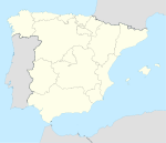
Basisdaten
Autonome Gemeinschaft: Aragonien
Provinz: Saragossa
Comarca: Ribera Alta del Ebro
Koordinaten 41° 52′ N, 1° 19′ W41.869166666667-1.3161111111111254Koordinaten: 41° 52′ N, 1° 19′ W
Höhe: 254 msnm
Fläche: 41,71 km²
Einwohner: 3.007 (1. Jan. 2010)[1]
Bevölkerungsdichte: 72,09 Einw./km²
Postleitzahl: 50650
Gemeindenummer (INE): 50118
Verwaltung
Bürgermeister: Antonio Luciano Liz Gaspar (CHA)
Webpräsenz der Gemeinde

Gallur ist eine spanische Gemeinde in der Provinz Saragossa, die zur Autonomen Region Aragonien gehört. Sie liegt im Nordwesten der Comarca (Kreis) Ribera Alta del Ebro direkt am Ebro und liegt zirka 50 km nordwestlich der Provinzhauptstadt Saragossa und gut fünf km nördlich der Autobahn AP-68, der Autopista Vasco-Aragonesa.

In der Zeit des Bürgerkrieges befand sich in Gallur ein Feldflugplatz der Nationalspanier, den auch Teile der deutschen Legion Condor insbesondere während der Schlacht von Teruel nutzten.

Weblinks

 Commons: Gallur – Sammlung von Bildern, Videos und Audiodateien

Einzelnachweise

  1. Population Figures referring to 01/01/2010. Bevölkerungsstatistiken des Instituto Nacional de Estadística.

Wikimedia Foundation.

Игры ⚽ Поможем решить контрольную работу

Schlagen Sie auch in anderen Wörterbüchern nach:

  • Gallur — Bandera …   Wikipedia Español

  • Gallur — Église de Saint Pierre (s. XVIII) …   Wikipédia en Français

  • Gallur — (population 2,899) is a small town and municipality in the Spanish Autonomical Region of Aragón, province of Zaragoza.The town of Gallur is located on a plain which stretches from the West Bank until the Moncayo High River Ebro, in the so called… …   Wikipedia

  • Gallur — Original name in latin Gallur Name in other language Gallur State code ES Continent/City Europe/Madrid longitude 41.8683 latitude 1.31577 altitude 249 Population 2925 Date 2012 03 04 …   Cities with a population over 1000 database

  • Gallur — ► Mun. de la prov. española de Zaragoza; 2 942 h …   Enciclopedia Universal

  • Camino de Santiago de Soria — Saltar a navegación, búsqueda La Ruta Jacobea de Soria o Camino Castellano Aragonés es una alternativa al Camino de Santiago del Ebro empleada por muchos peregrinos que en Gallur optan por desviarse hacia el oeste, pasando por Soria y alcanzando… …   Wikipedia Español

  • Estación de ferrocarril de Logroño — Saltar a navegación, búsqueda 42°27′27.64″N 2°26′32.25″O / 42.4576778 …   Wikipedia Español

  • Frula — Este artículo o sección sobre historia necesita ser wikificado con un formato acorde a las convenciones de estilo. Por favor, edítalo para que las cumpla. Mientras tanto, no elimines este aviso puesto el 25 de noviembre de 2010. También puedes… …   Wikipedia Español

  • Línea 25 (EMT Madrid) — 25 Ópera Casa de Campo paradas de ida 30 paradas de vuelta 31 km ida 10,1 km vuelta 9,5 Distrito(s) Centro …   Wikipedia Español

  • Гальур — Муниципалитет Гальур Gallur Флаг Герб …   Википедия

Share the article and excerpts

Direct link
Do a right-click on the link above
and select “Copy Link”