- Garry (Tummel)
-
Garry 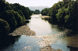
River Garry bei Blair Atholl
Daten Lage Perth and Kinross, Schottland Flusssystem Tay Abfluss über Tummel → Tay → Firth of Tay → Nordsee Flussgebietseinheit RBD Scotland Quellsee Loch Garry
56° 49′ 17″ N, 4° 13′ 40″ W56.8213-4.2277Mündung nördlich Pitlochry in den Tummel 56.718-3.779Koordinaten: 56° 43′ 5″ N, 3° 46′ 44″ W
56° 43′ 5″ N, 3° 46′ 44″ W56.718-3.779Länge 35 km Rechte Nebenflüsse Errochty Water Linke Nebenflüsse Allt Coire Luidhearnaidh, Bruar Water, Tilt Gemeinden Blair Atholl Der Garry ist ein Fluss im schottischen Hochland in der Unitary Authority Perth and Kinross.
Die Quelle des Garry ist Loch Garry. Der Fluss verlässt den See an dessen nördlichen Ende. Kurz nach dem Austritt aus dem See mündet der Allt Coire Luidhearnaidh in den Fluss. Danach fließt der Garry für 35 km nach Südosten, um circa 3 km nördlich von Pitlochry in den Tummel zu münden.
Auf fast seiner gesamten Strecke fließt der River Garry durch das Glen Garry entlang der A9. Auf dieser Strecke nimmt er nach circa 20 km das Wasser des Errochty Water auf und passiert nach etwa 25 km den Ort Blair Atholl, wo der River Tilt in den River Garry mündet. Kurz vor der Mündung des Errochty Water fließt das Wasser des Garry über mehrere bei Touristen beliebte Wasserfälle. Der River Garry ist ein Angelgebiet, in dem vor allem Forellen gefangen werden können.
Weblinks
- Beschreibung des Sees (en.)
- Informationen für Angler (en.)
 Die Stromschnellen im River Garry
 Kategorien:
- Flusssystem Tay
- Fluss in Schottland
- Fluss in Europa
- Gewässer (Perth and Kinross)


Wikimedia Foundation.