- Gmina Złotów
-
Gmina Złotów 
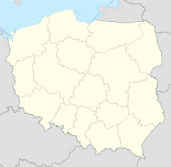

Gmina Złotów Basisdaten Staat: Polen Woiwodschaft: Großpolen Landkreis: Złotów Geographische Lage: 53° 22′ N, 17° 2′ O53.36666666666717.033333333333Koordinaten: 53° 22′ 0″ N, 17° 2′ 0″ O Einwohner: -
(31. Dez. 2010)[1]Telefonvorwahl: (+48) 67 Kfz-Kennzeichen: PZL Gemeinde Gemeindeart: Landgemeinde Gemeindegliederung: 45 Ortschaften 27 Schulzenämter Fläche: 292,5 km² Einwohner: 9307
(31. Dez. 2010) [2]Bevölkerungsdichte: 32 Einw./km² Gemeindenummer (GUS): 3031082 Verwaltung Bürgermeister: Kazimierz Trela Adresse: ul. Leśna 7
77-400 ZłotówWebpräsenz: www.gminazlotow.pl Die Gmina Złotów ist eine polnische Landgemeinde, die ihren Amtssitz in der Stadt Złotów hat, wobei die Stadt selbst nicht zum Gemeindegebiet gehört. Die Gemeinde ist dem Powiat Złotowski zugeordnet und gehört seit 1998 zur Woiwodschaft Großpolen, bis dahin zur Woiwodschaft Piła. Die Gemeinde umfasst eine Fläche von 292,5 km², was 17,61 % der Gesamtfläche des Powiat Złotowski entspricht und hat 9.000 Einwohner.
Inhaltsverzeichnis
Geographie
Die Gemeinde umgibt die Stadt Złotów gänzlich. Die östliche Gemeindegrenze ist identisch mit der zwischen 1920 und 1939 bestehenden Trennungslinie zwischen Deutschland und Polen (siehe Polnischer Korridor). Das Gemeindegebiet wird von kleineren Flüssen durchzogen, darunter die Glomia (Glumia), Skicka Struga (Kietzer Bach) und die Śmiardówka (Katzenbach).
Die Nachbargemeinden der Gmina Złotów sind: Die Stadt Złotów sowie die Gemeinden Jastrowie (Jastrow), Krajenka (Krojanke), Lipka (Linde), Łobżenica (Lobens), Okonek (Ratzebuhr), Tarnówka (Tarnowke), Wysoka (Wisseck/Weißeck) und Zakrzewo (Buschdorf).
Gemeindegliederung
Zur Landgemeinde Złotów gehören 45 Ortschaften, die 27 Ortsteilen („Schulzenämter“) zugeordnet sind.
- Ortsteile:
- Bielawa (Mariannenhof)
- Blękwit (Blankwitt)
- Bługowo (Blugowo, 1939-45 Wehlehof)
- Buntowo (Buntowo, 1939-45 Seefelde)
- Dzierzążenko (Gresonser Feld)
- Franciszkowo (Franziskowo)
- Górzna (Gursen)
- Józefowo (Josephowo)
- Kamień (Hohenfier)
- Kleszczyna (Kleschin, bis 1909 Klesczin)
- Klukowo (Klukowo, 1939-45 Blankenfelde)
- Krzywa Wieś (Krummenfließ)
- Międzybłocie (Stadtbruch)
- Nowa Święta (Neu Schwente)
- Nowiny (Nowinni, 1939-45 Bruchhof)
- Nowy Dwór (Neuhof)
- Pieczynek (Neu Petzin)
- Płosków (Friedrichsbruch)
- Radawnica (Radawnitz)
- Rudna (Ruden)
- Skic (Skietz, 1939-45 Kietz)
- Sławianowo (Slawianowo, 1939-45 Steinmark)
- Stare Dzierząźno (Gresonse)
- Stawnica (Stewnitz)
- Święta (Schwente)
- Wąsosz (Wonzow)
- Zalesie (Petzin)
Übrige Ortschaften: Bługowiec, Gajek, Grodno (Bergelau), Kaczochy (Karlshof), Kleszczynka (Wilhelmsee), Kobylnik (Kobilnik), Krzywa Wieś-Leśniczówka (Krummengließ-Forst), Łopienko (Buhental), Nowa Kleszczyna (Neu Kleschin), Nowa Święta-Leśniczkówka (Neu Schwente-Forst), Nowa Święta-Osada (Neu Schwente-Siedlung), Nowiny-Osada (Bruchhof-Siedlung), Pieczyn (Louisenhof), Rosochy (Roßochen), Sławianówko (Slawianowko), Stawnicki Młyn, Stawno und Wielatowo (Lindenhof).
Persönlichkeit aus dem Gemeindegebiet
Blankwitt, heute polnisch Blęwit
- Herbert Pankau (* 1941), deutscher Fußballspieler
Verweise
Weblinks
- Offizielle Website der Gmina (Polnisch)
Fußnoten
- ↑ Population. Size and Structure by Territorial Division. As of December 31, 2010. Główny Urząd Statystyczny (GUS), abgerufen am 23. Juni 2011.
- ↑ Population. Size and Structure by Territorial Division. As of December 31, 2010. Główny Urząd Statystyczny (GUS), abgerufen am 23. Juni 2011.
Schlagen Sie auch in anderen Wörterbüchern nach:
Gmina Złotów — Infobox Settlement name = Gmina Złotów other name = Złotów Commune settlement type = Gmina total type = Total image shield = subdivision type = Country subdivision name = POL subdivision type1 = Voivodeship subdivision name1 = Greater Poland… … Wikipedia
Gmina Okonek — Okonek Commune Gmina … Wikipedia
Złotów — (Stadt) … Deutsch Wikipedia
Złotów County — Infobox Settlement name = Złotów County native name = Powiat złotowski settlement type = County total type = Total image shield = POL powiat złotowski COA.svg map caption = Location within the voivodeship subdivision type = Country subdivision… … Wikipedia
Zlotow — Złotów … Deutsch Wikipedia
Gmina Zakrzewo — may refer to either of the following rural gminas (municipalities) in Poland: *Gmina Zakrzewo in Aleksandrów County, Kuyavian Pomeranian Voivodeship *Gmina Zakrzewo in Złotów County, Greater Poland Voivodeship … Wikipedia
Złotów — Infobox Settlement name = Złotów imagesize = 250px image caption = Urban Lake, view over the Złotów Old Town image shield = POL Złotów COA 1.svg pushpin pushpin label position = bottom subdivision type = Country subdivision name = POL subdivision … Wikipedia
Gmina Jastrowie — Infobox Settlement name = Gmina Jastrowie other name = Jastrowie Commune settlement type = Gmina total type = Total image shield = POL Jastrowie COA.svg subdivision type = Country subdivision name = POL subdivision type1 = Voivodeship subdivision … Wikipedia
Gmina Krajenka — Infobox Settlement name = Gmina Krajenka other name = Krajenka Commune settlement type = Gmina total type = Total image shield = subdivision type = Country subdivision name = POL subdivision type1 = Voivodeship subdivision name1 = Greater Poland… … Wikipedia
Gmina Lipka — Infobox Settlement name = Gmina Lipka other name = Lipka Commune settlement type = Gmina total type = Total image shield = POL Lipka COA.jpg subdivision type = Country subdivision name = POL subdivision type1 = Voivodeship subdivision name1 =… … Wikipedia
Gmina Złotów


18+
© Academic, 2000-2024
- Kontaktieren Sie uns: Unterstützung, Werbung
Wörterbücher Export, schritte mit PHP, Joomla, Drupal, WordPress, MODx.