- Goldstream Provincial Park
-
Goldstream Provincial Park IUCN-Kategorie II 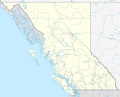

Lage: British Columbia (Kanada) Geographische Lage: 48° 28′ N, 123° 33′ W48.466666666667-123.55Koordinaten: 48° 28′ 0″ N, 123° 33′ 0″ W Fläche: 3,79 km² Einrichtungsdatum: 1958 Verwaltungsbehörde: BC Parks  Einer der größeren Bäume im Park
Der Goldstream Provincial Park ist ein Provinzpark in der kanadischen Provinz British Columbia. Er liegt in der Stadt Langford rund 16 km nordwestlich von Victoria auf Vancouver Island und erstreckt sich über eine Fläche von 3,79 km². 1994 wurde das Gebiet des höchsten Berges im Gebiet um Victoria, des Mt Finlayson, dem Park zugeschlagen, so dass der Park heute 4,77 km² umfasst.
Der namengebende Goldstream River weist von Ende Oktober bis in den November starke Lachswanderungen (chum salmon) auf und beherbergt eine große Population von Weißkopfseeadlern. Die Lachse wandern vom Pazifik über den Finlayson Arm in den Park. Auch Schwarzbären, Pumas (Cougars), Otter, Biber und zahlreiche Nagetierarten leben im Park.
Die Niagara Falls stürzen 47,3 m tief in ein Becken, hingegen sind die Goldstream Falls nur wenige Meter hoch.
Darüber hinaus finden sich hier noch Bestände von bis zu 600 Jahre alten Douglasien, Riesenlebensbaum, Western Hemlock, Black Cottonwood, Ahorn, aber auch Arbutus und Lodgepole Pine sowie zahlreiche Blütenpflanzen. Hinzu kommt eine selten gewordene Eichenart, die Garry oak.
Im Park befindet sich das von RLC Enterprize unterhaltene Goldstream Nature House. Es bietet Ausbildungs- und Bildungsprogramme sowie Ausstellungen zur Naturgeschichte des Parks.
 Südlich des Finlayson Arm im Goldstream Provincial Park
Geschichte
Mehrere First Nations nutzten den Goldstream River zum fischen, insbesondere während der Lachswanderungen. Mitte des 19. Jahrhunderts fand man dort Gold, was einen kurzlebigen Goldrausch auslöste. Die Goldsucher verließen das Gebiet meist nach kurzer Zeit, um an anderen Orten weiterzusuchen.
Obwohl die meisten die Region verließen, blieben doch einige in Victoria, so dass die Hauptstadt der Provinz schnell wuchs. Um ihre Wasserversorgung zu gewährleisten, entstand eine Wasserleitung vom Goldstream River in die Stadt. Der für die Leitung zuständige Greater Victoria Water Board übergab das Gebiet 1958 der Provinz.
1994 und 1996 kamen weitere Gebiete hinzu, wie das Gebiet am Mt Finlayson.
Am 16. April 2011 kam es zu einem Tanklastwagenunglück, bei dem erhebliche Mengen Diesel in den Fluss gerieten.
Weblinks
Kategorien:- Provincial Park in British Columbia
- Vancouver Island


Wikimedia Foundation.