Carrathool Shire

Carrathool Shire
Shire of Carrathool
Australia-Map-NSW-LGA-Carrathool.png
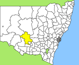
Lage des Carrathool Shire in New South Wales
Gliederung
Staat: Australien Australien
Bundesstaat: Flag of New South Wales.svg New South Wales
Verwaltungssitz: Goolgowi
Daten und Zahlen
Fläche: 18.940 km²
Einwohner: 2.819 (2006) [1]
Bevölkerungsdichte: 0,1 Einwohner je km²
Wards: 5
-33.966666666667145.7

Carrathool Shire ist ein lokales Verwaltungsgebiet (LGA) im australischen Bundesstaat New South Wales. Das Gebiet ist 18.940 km² groß und hat etwa 2.800 Einwohner.

Carrathool ist das größte Shire der Murrumbidgee-Region in der Südhälfte des Staates und liegt etwa 610 km westlich der Metropole Sydney und 425 km nordwestlich der australischen Hauptstadt Canberra. Das Gebiet umfasst 53 Ortsteile und Ortschaften, darunter Carrathool, Goolgowi, Hillston, Merriwagga und Rankins Springs. Der Sitz des Shire Councils befindet sich in der Ortschaft Goolgowi im Südosten der LGA, wo knapp 300 Einwohner leben.

Verwaltung

Der Carrathool Council hat zehn Mitglieder, die von den Bewohnern der fünf Wards gewählt werden (je zwei Councillor aus A, B, C, D und E Ward). Diese fünf Bezirke sind unabhängig von den Ortschaften festgelegt. Aus dem Kreis der Councillor rekrutiert sich auch der Mayor (Bürgermeister) des Councils.

Weblinks

Einzelnachweise

  1. Australian Bureau of Statistics (25. Oktober 2007): Carrathool (A) (Local Government Area) (Englisch). 2006 Census QuickStats. Abgerufen am 6. April 2010.

Wikimedia Foundation.

Игры ⚽ Поможем сделать НИР

Schlagen Sie auch in anderen Wörterbüchern nach:

  • Carrathool Shire Council — Infobox Australian Place | type = lga name = Carrathool Shire state = nsw caption = Location in NSW pop = 3,301Census 2001 AUS|id=LGA11600|name=Carrathool (A) (Local Government Area)|accessdate=2007 06 30|quick=on] area = 18932.61 area footnotes …   Wikipedia

  • Carrathool — refers to two related entities*Carrathool, New South Wales, a town in Australia; or *Carrathool Shire Council, the Local Government Area containing the town and the surrounding district …   Wikipedia

  • Carrathool, New South Wales — Infobox Australian Place | type = town name = Carrathool state = nsw caption = The Family Hotel at Carrathool lga = Carrathool postcode = 2711 est = pop = 99 (est.) elevation= 104 maxtemp = mintemp = rainfall = county = Sturt stategov =… …   Wikipedia

  • Wakool Shire — Shire of Wakool New South Wales Location in New South Wales Population: 4,427(2009) …   Wikipedia

  • Narrandera Shire — New South Wales Location in New South Wales Population: 6 …   Wikipedia

  • Murrumbidgee Shire — New South Wales Murrumbidgee Shire office and chambers Populat …   Wikipedia

  • Conargo Shire — New South Wales Location in New South Wales Population: 1,700(2009) …   Wikipedia

  • Murray Shire — This article is about the Murray Shire in New South Wales. For the Western Australia shire, see Shire of Murray. Murray Shire New South Wales …   Wikipedia

  • Cobar Shire — New South Wales Location in New South Wales Population: 5 …   Wikipedia

  • Corowa Shire — New South Wales Location in New South Wales Population: 11,685(2009) …   Wikipedia

Share the article and excerpts

Direct link
Do a right-click on the link above
and select “Copy Link”