- Inishturk
-
Inishturk (Inis Toirc) Lage der Insel
Gewässer Atlantischer Ozean Geographische Lage 53° 42′ 5″ N, 10° 6′ 30″ W53.701388888889-10.108333333333187Koordinaten: 53° 42′ 5″ N, 10° 6′ 30″ W 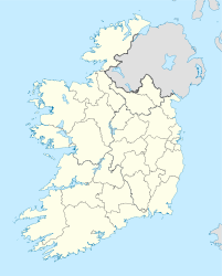

Länge 4,3 km Breite 2,2 km Fläche 5,85 km² Höchste Erhebung Inishturk
187 mEinwohner 58 (2006)
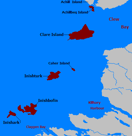
9,9 Einw./km²Hauptort Garranty Inishturk (irisch: Inis Toirc; deutsch: „Wildschwein-Insel“) ist eine bewohnte Insel in der Clew Bay vor der Küste des County Mayo in Irland. Die Insel erreicht eine Höhe von 187 Metern.[1] Die Nachbarinseln sind Caher Island, Clare Island und Inishbofin. Es gibt zwei Siedlungen mit zusammen etwa 70 Bewohnern auf der 12 km² großen Insel, Ballyheer und Garranty, die beide liegen auf der meerabgewandten östlichen Seite der Insel liegen. Dazwischen liegt auf dem Gipfel der Mountain Common. Aufgegebene Siedlungen sind Bellavaun und Craggy. Einige Bewohner stammen von der evakuierten Insel Inishark. Seit 2003 ist die Insel an das Stromnetz angeschlossen.
Eine regelmäßige Fähre verbindet Inishturk Harbour mit Roonagh Pier auf dem Festland. An der Westküste steht ein während der Napoleonischen Kriege errichteter Martello-Turm.
Weblinks
Einzelnachweise
Kategorien:- Insel (Irland)
- Insel (Europa)
- Insel (Atlantischer Ozean)
- County Mayo

Wikimedia Foundation.