- Karsin
-
Karsin 
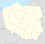

Karsin Basisdaten Staat: Polen Woiwodschaft: Pommern Landkreis: Kościerzyna Geographische Lage: 53° 54′ N, 17° 56′ O53.90517.928333333333Koordinaten: 53° 54′ 18″ N, 17° 55′ 42″ O Einwohner: -
(31. Dez. 2010)[1]Postleitzahl: 83-440 Telefonvorwahl: (+48) 58 Kfz-Kennzeichen: GKS Gemeinde Gemeindeart: Landgemeinde Gemeindegliederung: 11 Schulzenämter Fläche: 169,2 km² Einwohner: 6027
(31. Dez. 2010) [2]Bevölkerungsdichte: 36 Einw./km² Gemeindenummer (GUS): 2206032 Verwaltung (Stand: 2010) Gemeindevorsteher: Roman Brunke Adresse: ul. Długa 222
83-440 KarsinWebpräsenz: www.karsin.pl Karsin (deutsch: Karschin) ist ein Dorf und Sitz der gleichnamigen Landgemeinde in Polen. Es liegt im Powiat Kościerski der Wojewodschaft Pommern.
Gemeinde
Zur Landgemeinde Karsin gehören 11 Ortsteile (deutsche Namen bis 1945)[3] mit einem Schulzenamt:
- Bąk (Bak)
- Borsk (Borsk)
- Cisewie (Eibenfelde)
- Dąbrowa (Dombrowo)
- Górki
- Karsin (Karschin, 1939–1945: Karßin)
- Osowo (Ossowo)
- Przytarnia (Wildau)
- Wdzydze Tucholskie (Weitsee)
- Wiele
- Zamość
Weitere Ortschaften der Gemeinde sind:
- Abisynia
- Białe Błoto
- Dębowiec
- Jasnochówka
- Joniny Małe
- Joniny Wielkie
- Kliczkowy
- Knieja
- Lipa
- Malary
- Miedzno
- Mniszek (Mischke, 1939–1945: Mieschke)
- Piątkowo
- Podrąbiona
- Popia Góra (Popiagora)
- Przydół
- Robaczkowo
- Rogalewo
- Zabrody
- Żebrowo
Weblinks
 Commons: Karsin – Sammlung von Bildern, Videos und Audiodateien
- Website der Gemeinde (polnisch)
Fußnoten
- ↑ Population. Size and Structure by Territorial Division. As of December 31, 2010. Główny Urząd Statystyczny (GUS), abgerufen am 6. August 2011.
- ↑ Population. Size and Structure by Territorial Division. As of December 31, 2010. Główny Urząd Statystyczny (GUS), abgerufen am 6. August 2011.
- ↑ Das Genealogische Orts-Verzeichnis
 Städte und Gemeinden im Powiat Kościerski (Landkreis Berent)
Städte: Kościerzyna (Berent)
Landgemeinden: Dziemiany (Dzimianen) | Karsin (Karschin) | Kościerzyna – Gmina (Berent – Land) | Liniewo (Lienfelde) | Lipusz (Lippusch) | Nowa Karczma (Neukrug) | Stara Kiszewa (Alt Kischau)
Wikimedia Foundation.
Schlagen Sie auch in anderen Wörterbüchern nach:
Karsin — Original name in latin Karsin Name in other language State code PL Continent/City Europe/Warsaw longitude 53.90768 latitude 17.92093 altitude 146 Population 2500 Date 2010 09 13 … Cities with a population over 1000 database
Karsin (PKP station) — Infobox PKP station name = Karsin city = Karsin district = address = prec = Czersk following = Bąk water tower = Never existed depot = Never existed platforms = No info building = Yes (no longer used) start = prev name = Karsin is a former PKP… … Wikipedia
karşın — zf. Gerekenin veya mantığın tersine olarak, rağmen … Çağatay Osmanlı Sözlük
Gmina Karsin — Infobox Settlement name = Gmina Karsin other name = Karsin Commune settlement type = Gmina total type = Total image shield = subdivision type = Country subdivision name = POL subdivision type1 = Voivodeship subdivision name1 = Pomeranian… … Wikipedia
karšinčius — karšiñčius sm. (2) 1. scom. Š senas, paliegęs, baigiantis savo amžių žmogus: Iš jo jau karšiñčius – dirbti jau nėko negalia Klm. Karšinčius gyvenime blogiau kaip mažas vaikas Ub. Jis vienų vienas, yra tik tėvas karšinčius Bsg. Jau tokia… … Dictionary of the Lithuanian Language
Cisewie — Village … Wikipedia
Dąbrowa, Kościerzyna County — Dąbrowa Village … Wikipedia
Dębowiec, Pomeranian Voivodeship — For other places with the same name, see Debowiec. Dębowiec Settlement … Wikipedia
Górki, Kościerzyna County — For other places with the same name, see Górki (disambiguation). Górki Village … Wikipedia
Malary, Kościerzyna County — See also: Malary, Starogard County Malary Village … Wikipedia
Karsin


18+
© Academic, 2000-2024
- Kontaktieren Sie uns: Unterstützung, Werbung
Wörterbücher Export, schritte mit PHP, Joomla, Drupal, WordPress, MODx.