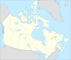
- Lake Superior National Marine Conservation Area
-
Lake Superior National Marine Conservation Area Lage: Ontario, Kanada Fläche: 10000 km² Länge: 140 km Gründung: Oktober 2007 48.435-89.220555555556Koordinaten: 48° 26′ 6″ N, 89° 13′ 14″ WDie Lake Superior National Marine Conservation Area ist ein nationales Schutzgebiet in Kanada. Es erstreckt sich über 140 km entlang des Nordufers des Oberen Sees in Ontario, genauer zwischen Thunder Bay im Westen und Bottle Point im Osten. Die Südgrenze liegt an der durch den See verlaufenden Grenze zwischen Kanada und den USA, wo auch der Isle Royale National Park beginnt.[1]
Der Parkgründung im Oktober 2007, die Ministerpräsident Stephen Harper kurzfristig angekündigt hatte[2] waren mehrjährige Verhandlungen vorausgegangen, ebenso wie Untersuchungen seit 1997 erfolgt waren. 2002 wurde der zugehörige Canada National Marine Conservation Areas Act verabschiedet.
Die First Nations wurden dabei von Wilfred King vertreten, dem Grand Chief der Region am nördlichen Lake Superior. Sie setzten 2006 durch, dass die Bestimmungen des als Robinson Superior Treaty bekannten Vertrags von 1850 eingehalten wurden.[3] Rund zwei Drittel der Bevölkerung der Umgebung stimmten in einem Referendum für die maximale Ausdehnung, die bei Parkgründung umgesetzt wurde.
Der Park umfasst rund 10.000 km² Wassergebiet einschließlich der Ufer, dazu rund 60 km² Inseln. In diesem Gebiet ist jede Rohstoffgewinnung strikt untersagt, wobei die lokalen Indianer entsprechend älterer vertraglicher Abmachungen fischen dürfen.
2009 wurden die acht Wilson Islands vor Rossport für 7,4 Millionen Dollar erworben, die bis dahin in Privatbesitz waren. Sie umfassen eine Fläche von 1900 ha.[4] Die Regierungen von Kanada und Ontario, sowie Privatorganisationen Kanadas und der USA trugen entsprechende Mittel bei. Unterstützung fand der Kauf durch die lokale Pays Plat First Nation, die beim Schutz der Insel eine erhebliche Rolle spielt. Das gilt auch für die Felszeichnungen und die Sibley Peninsula, die Artefakte der Paläo-Indianer und der nachfolgenden Kulturen birgt.
Siehe auch
Weblinks
Anmerkungen
- ↑ Lake Superior National Marine Conservation Area of Canada, Parks Canada.
- ↑ Harper announces creation of protected marine park|publisher, CBC News
- ↑ Copy of the Robinson Treaty Made in the Year 1850 with the Ojibewa Indians of Lake Superior Conveying Certain Lands to the Crown
- ↑ Lake Superior News, 27. September 2009
Kategorien:- Oberer See
- Nationalpark in Kanada
- Geographie (Ontario)
- Nationalpark in Nordamerika
Wikimedia Foundation.

