- Lubasz
-
Lubasz 

Lubasz Basisdaten Staat: Polen Woiwodschaft: Großpolen Landkreis: Czarnków-Trzcianka Geographische Lage: 52° 51′ N, 16° 31′ O52.85166666666716.523055555556Koordinaten: 52° 51′ 6″ N, 16° 31′ 23″ O Einwohner: 2861 (2009)
Postleitzahl: 64-720 Telefonvorwahl: (+48) 67 Kfz-Kennzeichen: PCT Gemeinde Gemeindeart: Landgemeinde Gemeindegliederung: 15 Schulzenämter Fläche: 167,6 km² Einwohner: 7267
(31. Dez. 2010) [1]Bevölkerungsdichte: 43 Einw./km² Gemeindenummer (GUS): 3002052 Verwaltung (Stand: 2006) Bürgermeister: Jan Stefan Graczyk Adresse: ul. Chrobrego 37
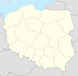
64-720 LubaszLubasz (deutsch: Lubasch) ist ein Dorf und Sitz einer Landgemeinde in Polen. Der Ort liegt im Powiat Czarnkowsko-Trzcianecki der Wojewodschaft Großpolen.
Gemeinde
Zur Landgemeinde Lubasz gehören 15 Ortsteile (deutsche Namen bis 1945)[2] mit einem Schulzenamt:
- Antoniewo (Antoniewo)
- Dębe
- Goraj-Bzowo
- Jędrzejewo
- Kamionka (Kamionka)
- Klempicz
- Krucz (Krutsch)
- Kruteczek
- Lubasz (Lubasch)
- Miłkowo
- Nowina (Nowina)
- Prusinowo
- Sławno
- Sokołowo (Jankendorf)
- Stajkowo
Weitere Ortschaften der Gemeinde sind Bończa, Bzowo, Elżbiecin und Miłkówko.
Einzelnachweise
- ↑ Population. Size and Structure by Territorial Division. As of December 31, 2010. Główny Urząd Statystyczny (GUS), abgerufen am 23. Juni 2011.
- ↑ Das Genealogische Orts-Verzeichnis
 Städte und Gemeinden im Powiat Czarnkowsko-Trzcianecki (Kreis Scharnikau-Schönlanke)
Stadtgemeinde: Czarnków
Stadt- und Landgemeinden: Krzyż Wielkopolski | Trzcianka | Wieleń
Landgemeinden: Czarnkow-Gmina | Drawsko | Lubasz | Połajewo
Wikimedia Foundation.
Schlagen Sie auch in anderen Wörterbüchern nach:
Lubasz — Original name in latin Lubasz Name in other language State code PL Continent/City Europe/Warsaw longitude 52.85213 latitude 16.52344 altitude 80 Population 2861 Date 2011 07 31 … Cities with a population over 1000 database
Lubasz, Lesser Poland Voivodeship — Infobox Settlement name = Lubasz settlement type = Village total type = image shield = subdivision type = Country subdivision name = POL subdivision type1 = Voivodeship subdivision name1 = Lesser Poland subdivision type2 = County subdivision… … Wikipedia
Gmina Lubasz — Infobox Settlement name = Gmina Lubasz other name = Lubasz Commune settlement type = Gmina total type = Total image shield = subdivision type = Country subdivision name = POL subdivision type1 = Voivodeship subdivision name1 = Greater Poland… … Wikipedia
Dębe, Czarnków-Trzcianka County — For other places with the same name, see Dębe (disambiguation). Dębe Village … Wikipedia
Miłkówko — Village … Wikipedia
Miłkowo, Greater Poland Voivodeship — For other places with the same name, see Miłkowo (disambiguation). Miłkowo Village … Wikipedia
Nowina, Czarnków-Trzcianka County — For other places with the same name, see Nowina (disambiguation). Nowina Village … Wikipedia
Czarnków-Trzcianka County — Powiat czarnkowsko trzcianecki County … Wikipedia
Гмина Любаш — Gmina Lubasz Герб Файл:POL gmina Lubasz COA.png Страна: Польша Повят: Чарнковско Тшчанецкий повят Глава: Ян Стефан Грачик (2006) Площадь: 167,58 км² Население: 6859 чел … Википедия
Wieleń — Wieleń … Deutsch Wikipedia
Lubasz


18+
© Academic, 2000-2024
- Kontaktieren Sie uns: Unterstützung, Werbung
Wörterbücher Export, schritte mit PHP, Joomla, Drupal, WordPress, MODx.