Mablethorpe

Mablethorpe
Mablethorpe
Vergnügungsmeile in Mablethorpe
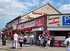
Koordinaten 53° 20′ N, 0° 16′ O53.34090.261Koordinaten: 53° 20′ N, 0° 16′ O
Mablethorpe (England)
Mablethorpe
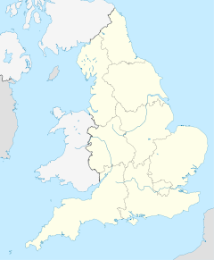
Mablethorpe
Bevölkerung 11.780 (Stand: 2001)
Verwaltung
Post town MABLETHORPE
Postleitzahlen­abschnitt LN12
Vorwahl 01507
Landesteil England
Region East Midlands
Shire county Lincolnshire
District East Lindsey
Britisches Parlament Louth and Horncastle
Website: mablethorpe.info

Mablethorpe ist eine Kleinstadt im District East Lindsey der englischen Grafschaft Lincolnshire. Sie bildet mit den Teilorten Sutton-on-Sea und Trusthorpe die Gemeinde Mablethorpe and Sutton, die im Jahr 2001 insgesamt 11.780 Einwohner zählte.

Inhaltsverzeichnis

Geografie

Das Seebad befindet sich 35 km Luftlinie südöstlich von Grimsby sowie 60 km östlich von Lincoln an der Nordseeküste.

Geschichte

Mablethorpe wurde von der Flutkatastrophe von 1953 hart getroffen.

Verkehr

Bei Mablethorpe beginnen bzw. enden die A-Straßen A52 (nach Newcastle-under-Lyme), A157 (nach Wragby, Anschluss nach Lincoln) und A1031 (nach Cleethorpes). Anschluss an das Fernstraßennetz erhält man über die nahegelegene A16 nach Norden bei Grimsby (M180) sowie nach Süden bei Peterborough (A1(M)).

Weblinks


Wikimedia Foundation.

Игры ⚽ Нужно сделать НИР?

Schlagen Sie auch in anderen Wörterbüchern nach:

  • Mablethorpe — infobox UK place country = England latitude= 53.3409 longitude= 0.261 map type= Lincolnshire official name= Mablethorpe population = 11,700 (with Sutton) shire district= East Lindsey shire county = Lincolnshire region= East Midlands constituency… …   Wikipedia

  • Mablethorpe — 53° 20′ 27″ N 0° 15′ 40″ E / 53.3409, 0.261 Mablethorpe est une petite ville au bord …   Wikipédia en Français

  • Mablethorpe — Original name in latin Mablethorpe Name in other language Mablethorpe State code GB Continent/City Europe/London longitude 53.3409 latitude 0.26102 altitude 2 Population 11700 Date 2012 06 01 …   Cities with a population over 1000 database

  • Mablethorpe and Sutton — is a civil parish and town in East Lindsey, Lincolnshire, England. It is on the North Sea coast and includes Mablethorpe, Trusthorpe, Sutton on Sea and Sandilands along with the inland village of Thorpe. According to the 2001 census it had a… …   Wikipedia

  • Mablethorpe railway station — was a station in the town of Mablethorpe, Lincolnshire which is now closed. [British Railways Atlas.1947. p.17] [ [http://homepage.ntlworld.com/david.enefer/elincs/elincs3a.htm E. Lincs Railway final weeks ] ] Former Services References …   Wikipedia

  • Lincolnshire — For other places with the same name, see Lincolnshire (disambiguation). Coordinates: 53°4′N 0°11′W / 53.067°N 0.183°W / 53.067; 0.183 …   Wikipedia

  • A52 road — UK road routebox road= A52 length mi= length km= direction= East West start= Newcastle under Lyme destinations= Stoke on Trent Ashbourne Derby Nottingham Grantham Boston Skegness end= Mablethorpe construction date= completion date= junctions=… …   Wikipedia

  • North Somercotes — Coordinates: 53°26′47″N 0°07′57″E / 53.446398°N 0.132638°E / 53.446398; 0.132638 …   Wikipedia

  • Mumby Road railway station — was a station on the Great Northern Railway between Willoughby and Mablethorpe. It served the village of Bilsby. It opened in 1888 and closed in 1970.[1] The station was immortalised in 1964 in the song Slow Train by Flanders and Swann.[2] [3]… …   Wikipedia

  • Skegness — Infobox UK place official name= Skegness country= England region= East Midlands population= 18,910 (2001 Census) os grid reference= TF5663 latitude= 53.1453 longitude= 0.3402 post town= SKEGNESS postcode area= PE postcode district= PE24, PE25… …   Wikipedia

Share the article and excerpts

Direct link
Do a right-click on the link above
and select “Copy Link”