- Mount Kuring-Gai
-
Mount Kuring-Gai 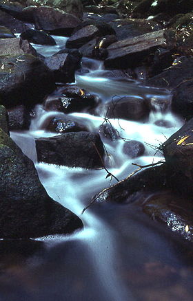
Kaskaden am Calna CreekStaat:  Australien
Bundesstaat:  New South Wales
Koordinaten: 33° 39′ S, 151° 8′ O-33.656438151.134147Koordinaten: 33° 39′ S, 151° 8′ O Einwohner: 1.550 (2006) [1] Zeitzone: AEST (UTC +10) Postleitzahl: 2080 LGA: Hornsby Shire 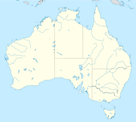

Mount Kuring-Gai Mount Kuring-Gai ist ein Vorort Sydneys mit 1.550 Einwohnern in New South Wales, Australien. Vororte, die an Mount Kring-Gai angrenzen, sind Berowra im Norden und Mount Colah im Süden. Umgeben von Buschland liegt der Ort am Ku-ring-gai-Chase-Nationalpark.
Ku-ring-Gai war seit Jahrtausenden das Land der Guringai, einem Stamm der Aborigine. In dem Ort wurde 1903 die Eisenbahnstation Kuring-gai gebaut und 1933 der Ort Mount Ku-ring-Gai genannt.
Der Ort wird durch Verkehrswege geteilt, dem Pacific Highway, der F3, dem Sydney-Newcastle Freeway und von der parallel verlaufenden North Shore Railway.
Im Osten des Ortes befinden sich eine Grundschule, Gemeinschaftshalle und ein Sportplatz, auf der westlichen Seite Einkaufszentren, die Mount Kuring-gai Railway Station und eine Telefongesellschaft. Die östliche und westliche Seite werden durch eine Straßen- und Fußgängerbrücke verbunden.
Ein Industriegebiet und Unternehmen wie eine Fabrik für Heißluftballone und ein Buchverlag in Mount Kuring-Gai stellen Arbeitsplätze für die Bevölkerung des Orts.
Im Vorort beginnen Wanderwege. Auch der Great North Walk geht hier entlang, der von Sydney ins Hunter Valley führt, sowie ein Weg zur Apple Tree Bay.
-

Einsatz eines Löschhubschraubers Shania ( Typ: N720HT) bei Mount Kuring-gai im April 2007
-

Felsenüberhang am Lyrebird Gully, wo gelegentlich Lyrebirds (deutsch: Leierschwänze) gesehen werden
Literatur
- The Book of Sydney Suburbs, Compiled by Frances Pollen, Angus & Robertson Publishers, 1990, Published in Australia ISBN 0-207-14495-8
Einzelnachweise
Kategorie:- Ort in New South Wales
-


Wikimedia Foundation.