Romsø

Romsø

Vorlage:Infobox Insel/Wartung/Bild fehltVorlage:Infobox Insel/Wartung/Höhe fehlt

Romsø
Gewässer Ostsee
Inselgruppe Großer Belt
Geographische Lage 55° 30′ 45″ N, 10° 47′ 15″ O55.512510.7875Koordinaten: 55° 30′ 45″ N, 10° 47′ 15″ O
Romsø (Syddanmark)
Romsø
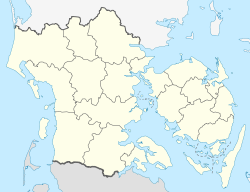
Fläche 1,09 km²
Einwohner (unbewohnt)

Romsø ist eine seit Ende der 1990er Jahre unbewohnte dänische Insel im Großen Belt vor der Ostküste Fyns (dt.: Fünen) am nördlichen Eingang zur Kerteminder Bucht. Die Insel gehört zur Kirchspielsgemeinde (dän.: Sogn) Viby (Viby Sogn), die bis 1970 zur Harde Bjerge Herred im damaligen Odense Amt gehörte. Danach gehörte es zur Kerteminde Kommune im damaligen Fyns Amt, die mit der Kommunalreform zum 1. Januar 2007 in der „neuen“ Kerteminde Kommune in der Region Syddanmark aufgegangen ist. Von 1869 bis 1973 wies ein Leuchtturm auf der Insel Seefahrern den Weg in die Bucht.

Einzelnachweise


Wikimedia Foundation.

Игры ⚽ Поможем написать реферат

Schlagen Sie auch in anderen Wörterbüchern nach:

  • Romso — ist eine Nachrichtensuchmaschine. Die Nachrichten werden analysiert und eine Zeitleiste passend zur Suchabfrage generiert. Die Zeitleiste wird mit automatisch errechneten Schlagwörtern erklärt. Im Gegensatz zu beispielsweise Google News werden… …   Deutsch Wikipedia

  • Romsø — is a Danish island in the Great Belt off the coast of Funen. It has an area of 1.09 km² and has, since 1996, no permanent residents. A defunct lighthouse and a few houses are located on the island; a substantial part of its area is covered by… …   Wikipedia

  • Romsø — Saltar a navegación, búsqueda Romsø es una isla de Dinamarca ubicada en el Gran Cinturón (Storebælt), no muy lejos de las costas de Fionia. La isla ocupa una superficie de 109 ha. Romsø es también una reserva ornitológica. Los ornitólogos han… …   Wikipedia Español

  • Romsø — Sp Ròmsė Ap Romsø L s. Baltijos j., Danija …   Pasaulio vietovardžiai. Internetinė duomenų bazė

  • List of islands of Denmark — Map showing some of the larger islands This is a list of islands of Denmark. Contents 1 Overview 1.1 …   Wikipedia

  • Kerteminde Municipality — is a municipality (Danish, kommune ) in Region Syddanmark on the northeast coast of the island of Funen in central Denmark. The municipality includes the island of Romsø, and it covers an area of 203 km². It has a total population of 23,630… …   Wikipedia

  • Great Belt Fixed Link — Infobox Bridge bridge name = The Great Belt Bridge (The East Bridge) caption = The East Bridge as seen from the Zealand side. official name = Østbroen carries = Motor vehicles crosses = Great Belt locale = maint = A/S Storebælt id = designer =… …   Wikipedia

  • Møn — The title of this article contains the character ø. Where it is unavailable or not desired, the name may be represented as Moen. Møn The white chalk Cliffs of Møn …   Wikipedia

  • North Jutlandic Island — Native name: Nørrejyske Ø The Grenen sand bar at the northern tip of the island …   Wikipedia

  • Mors (island) — Mors Hanklit, Mors Geography Location Limfjor …   Wikipedia

Share the article and excerpts

Direct link
Do a right-click on the link above
and select “Copy Link”