Rupat

Rupat

Vorlage:Infobox Insel/Wartung/Bild fehltVorlage:Infobox Insel/Wartung/Höhe fehlt

Rupat
Gewässer Straße von Malakka
Geographische Lage 1° 53′ N, 101° 35′ O1.8833333333333101.58333333333Koordinaten: 1° 53′ N, 101° 35′ O
Rupat (Sumatra)
Rupat
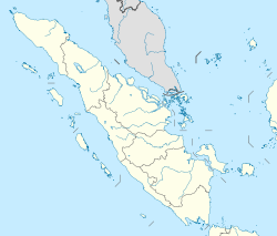
Länge 50 km
Breite 50 km
Fläche 1.490,2 km²
Einwohner ca. 30.000
20 Einw./km²
Hauptort Batu Panjang / Tanjung Medang

Rupat (indonesisch Pulau Rupat) ist eine indonesische Insel vor der Nordostküste Sumatras in der Straße von Malakka gelegen.

Geografie

Mit einer Fläche von 1490 km²[1] stellt sie nach Rantau die zweitgrößte einer ganzen Reihe von in dieser Region liegenden Inseln dar; die nächste dieser Inseln ist im Südosten Bengkalis.

Rupat ist eine angenähert kreisrunde und flache Insel mit einem Umfang von 154 km[1] sowie einem Durchmesser von etwa 50 km. Von der Insel Sumatra im Süden ist Rupat durch einen nur rund zwei Kilometer breiten Meeresarm, die Rupat-Straße (Selat Rupat), getrennt.

Verwaltung

Administrativ gehört die Insel zum Regierungsbezirk (Kabupaten) Bengkalis der Provinz Riau und besteht aus den zwei Unterdistrikten (Kecamatan) Rupat im Süden und Rupat Utara im Norden.[2] Rupat wird von etwa 30.000 Menschen bewohnt; die beiden bedeutendsten Siedlungen der Insel sind die jeweiligen Hauptorte der Unterdistrikte, Batu Panjang im Süden, sowie Tanjung Medang an der Nordküste.

Einzelnachweise

  1. a b UNEP Islands (englisch)
  2. Verwaltungskarte

Wikimedia Foundation.

Игры ⚽ Нужна курсовая?

Schlagen Sie auch in anderen Wörterbüchern nach:

  • Rupat — Géographie Pays  Indonesie !Indonésie Archipel Grandes îles de la Sonde …   Wikipédia en Français

  • Rupat — is an island in the Strait of Malacca, Riau province, Indonesia. It lies just off the eastern coast of Sumatra, across from Dumai city, across the Strait of Rupat (Selat Rupat). Its area is 1490 km². The island is sparsely populated …   Wikipedia

  • Rupat — Rupat, Insel in der Malaccastraße, nahe an der Ostküste von Sumatra …   Pierer's Universal-Lexikon

  • Rupat Island — ▪ island, Indonesia Indonesian  Pulau Rupat , Rupat also spelled  Roepat        island in the Strait of Malacca, Riau provinsi (province), Indonesia. It lies just off the eastern coast of Sumatra across a 3 mile (5 kilometre ) wide channel,… …   Universalium

  • Бенкалис (округ) — У этого термина существуют и другие значения, см. Бенкалис (значения). Бенкалис Bengkalis Герб …   Википедия

  • List of current ships of the Indonesian Navy — All the Navy Vessels are named with the KRI Initial. KRI (Kapal Perang Republik Indonesia) means Navy Vessel Of The Republic Of Indonesia. The class are often named after the lead ships. Naval Jack of Indonesia The navy includes Frigates,… …   Wikipedia

  • Malacca Strait Bridge — Jambatan/Jembatan Selat Melaka Official name Malacca Strait Bridge Carries Motor vehicles Crosses Straits of Malacca Locale Dumai Rupat Toll Road, Indonesia Telok Gong Masjid Tanah Alor Gajah …   Wikipedia

  • Riau — ▪ province, Indonesia       provinsi (“province”), east central Sumatra, Indonesia. It is bounded by the provinces of Jambi on the south, Sumatera Barat (West Sumatra) on the west, Sumatera Utara (North Sumatra) on the north and northwest, the… …   Universalium

  • Чихоткин, Виктор Фёдорович — Виктор Федорович Чихоткин Чихоткин Виктор Федорович Дата рождения …   Википедия

  • Islands of Indonesia — Indonesia comprises 17,508 islands (based from Seminar Nasional Penetapan Nama Pulau pulau Kecil Dalam Presektif Sejarah or National Seminary of Name For Little Islands From History Side , July 16 to 18 at Palembang, South Sumatra, Indonesia, now …   Wikipedia

Share the article and excerpts

Direct link
Do a right-click on the link above
and select “Copy Link”