- Russia Dock Woodland
-
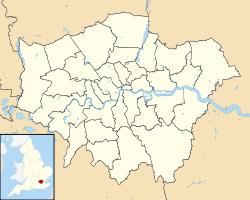

Russia Dock Woodland Lage des Russia Dock Woodlands in Greater London Plan der Surrey Commercial Docks (1921). Das Russia Dock ist in der Mitte zu sehen, das Stave Dock nordwestlich anschließend.
 Stave Hill und die Treppen zur Aussichtsplattform (Mai 2008)
Das Russia Dock Woodland ist ein schmaler Park in Rotherhithe (London), der durch das Verfüllen des ‘’’Russia Docks’’’, eines historischen Hafenbeckens der Surrey Commercial Docks entstand. Das Russia Dock diente ursprünglich als Liegeplatz für Schiffe aus Norwegen, Russland und Schweden, die Holz nach London brachten. Das Weichholz, das „Deal Wood“ genannt wurde, benutzte man hauptsächlich zur Herstellung von Druckpapier und Möbeln.
Nach Schließung der Hafenbecken in den 1970er-Jahren wurde das Gelände von der London Docklands Development Corporation (LDDC) umgestaltet. Das Russia Dock wurde verfüllt (mit Ausnahme eines dünnen Rinnsals durch die Waldpflanzung) und 1980 zu einer 140.000 m² großen Waldpflanzung aufgeforstet. Man kann dort immer noch einige überlebende Details des Hafenbeckens finden, so z.B. Firststeine der Mauern, Wasserstandsanzeiger, Poller, Ankerketten und Treidelpfade. 1985 legte die LDDC einen künstlichen Hügel, den Stave Hill am Westrand des Parks (anstelle des historischen Stave Docks) an, der aus dem Aushub des Albion Channel (anstelle des historischen Albion Docks) besteht. Auf der Spitze des Hügels ist eine Reliefkarte in Bronzeguss von Michael Rizzello angebracht, die die früheren Hafenbecken zeigt.
Weblinks
Kategorien:- Hafenanlagen in London
- London Borough of Southwark


Wikimedia Foundation.