- Sieroszewice
-
Sieroszewice 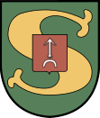
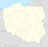

Sieroszewice Basisdaten Staat: Polen Woiwodschaft: Großpolen Landkreis: Ostrów Wielkopolski Geographische Lage: 51° 38′ N, 17° 58′ O51.63444444444417.969722222222Koordinaten: 51° 38′ 4″ N, 17° 58′ 11″ O Einwohner: 1014 (2006)
Postleitzahl: 63-405 Telefonvorwahl: (+48) 62 Kfz-Kennzeichen: POS Gemeinde Gemeindeart: Landgemeinde Gemeindegliederung: 18 Schulzenämter Fläche: 163,5 km² Einwohner: 9648
(31. Dez. 2010) [1]Bevölkerungsdichte: 59 Einw./km² Gemeindenummer (GUS): 3017072 Verwaltung Gemeindevorsteher: Czesław Tadeusz Berkowski Adresse: ul. Ostrowska 65
63-405 SieroszewiceWebpräsenz: www.sieroszewice.pl Sieroszewice (deutsch Sieroszewice, 1943–1945 Langenheim) ist ein Dorf und Sitz der gleichnamigen Landgemeinde in Polen. Der Ort liegt im Powiat Ostrowski (Großpolen) der Wojewodschaft Großpolen.
Gemeinde
Zur Landgemeinde Sieroszewice gehören 18 Ortsteile (deutsche Namen bis 1945)[2][3][4][5] mit einem Schulzenamt:
- Bibianki (Bibianki)[3]
- Biernacice (Biernacice, 1939–1945 Bernhardsruh)[5]
- Bilczew (Bilczew, 1939–1945 Bilau)[3]
- Kania (Kania, 1939–1945 Weihen)
- Latowice (Latowitz, 1939–1945 Sommerstein)[3]
- Masanów (Masanow, 1939–1945 Massenau)
- Namysłaki
- Ołobok (Olobok, 1939–1943 Altdorf, 1943–1945 Ollebach)[4]
- Parczew (Parczew, 1939–1945 Winkelsdorf)[3]
- Psary (Psary, 1939–1945 Wolfshagen)[4]
- Raduchów (Raduchow, 1939–1945 Raden)[5]
- Rososzyca (Rossoszyce, 1939–1945 Rosenberg)[4]
- Sieroszewice (Sieroszewice, 1939–1945 Langenheim)[3]
- Sławin (Slawin, 1939–1945 Sandwalde)[4]
- Strzyżew (Strzyzew, 1939–1945 Deutschdorf)[3]
- Westrza (Westrza)[3]
- Wielowieś (Wielowies, 1939–1943 Großdorf, 1943–1945 Wielendorf)[4]
- Zamość (Zamosc, 1939–1945 Prosnau)
Weblinks
- Amtsbezirk Langenheim
- Deutsche Topograph. Karte, 4373 Gr_Wysotzko (1:25000), Ausgabe 1 vom XI. 1944
- Deutsche Topograph. Karte, 4374 Olobok (1:25000), Ausgabe 1 vom XI. 1944
- Deutsche Topograph. Karte, 4474 Grabow (1:25000), Ausgabe 1 vom XI. 1944
Fußnoten
- ↑ Population. Size and Structure by Territorial Division. As of December 31, 2010. Główny Urząd Statystyczny (GUS), abgerufen am 23. Juni 2011.
- ↑ Das Genealogische Orts-Verzeichnis
- ↑ a b c d e f g h Vgl. Deutsche Topograph. Karte, 4373 Gr_Wysotzko
- ↑ a b c d e f Vgl. Deutsche Topograph. Karte, 4374 Olobok
- ↑ a b c Vgl. Deutsche Topograph. Karte, 4474 Grabow
 Städte und Gemeinden im Powiat Ostrowski
Nowe Skalmierzyce (Neu Skalmierschütz) – Stadt | Odolanów (Adelnau) – Stadt | Ostrów Wielkopolski (Ostrowo) – Stadt | Przygodzice | Raszków – Stadt | Sieroszewice | Sośnie
Wikimedia Foundation.
Schlagen Sie auch in anderen Wörterbüchern nach:
Sieroszewice — Original name in latin Sieroszewice Name in other language State code PL Continent/City Europe/Warsaw longitude 51.63347 latitude 17.972 altitude 149 Population 1014 Date 2010 10 16 … Cities with a population over 1000 database
Gmina Sieroszewice — Infobox Settlement name = Gmina Sieroszewice other name = Sieroszewice Commune settlement type = Gmina total type = Total image shield = POL gmina Sieroszewice COA.svg subdivision type = Country subdivision name = POL subdivision type1 =… … Wikipedia
Masanów — Village … Wikipedia
Namysłaki — Village … Wikipedia
Ołobok, Greater Poland Voivodeship — For other places with the same name, see Ołobok (disambiguation). Ołobok Village … Wikipedia
Ostrów Wielkopolski County — Powiat ostrowski County … Wikipedia
Gmina Nowe Skalmierzyce — Nowe Skalmierzyce Commune Gmina … Wikipedia
Gmina Ostrów Wielkopolski — Ostrów Wielkopolski Commune Gmina … Wikipedia
Kreis Ostrowo — Der Kreis Ostrowo im Südosten der preußischen Provinz Posen bestand in der Zeit von 1887 bis 1918. Inhaltsverzeichnis 1 Vorgeschichte 1.1 1793 bis 1807 1.2 1815 bis 1887 2 Verwaltungsge … Deutsch Wikipedia
Powiat Ostrowski (Großpolen) — Powiat Ostrowski … Deutsch Wikipedia
Sieroszewice


18+
© Academic, 2000-2024
- Kontaktieren Sie uns: Unterstützung, Werbung
Wörterbücher Export, schritte mit PHP, Joomla, Drupal, WordPress, MODx.