- Suchy Dąb
-
Suchy Dąb 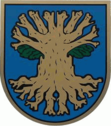

Suchy Dąb Basisdaten Staat: Polen Woiwodschaft: Pommern Landkreis: Gdańsk Fläche: 13,4 km² Geographische Lage: 54° 12′ N, 18° 46′ O54.20666666666718.7675Koordinaten: 54° 12′ 24″ N, 18° 46′ 3″ O Einwohner: 832 (2006)
Postleitzahl: 83-022 Telefonvorwahl: (+48) 58 Kfz-Kennzeichen: GDA Gemeinde Gemeindeart: Landgemeinde Gemeindegliederung: 13 Ortschaften 8 Schulzenämter Fläche: 85 km² Einwohner: 4034
(31. Dez. 2010) [1]Bevölkerungsdichte: 47 Einw./km² Gemeindenummer (GUS): 2204072 Verwaltung (Stand: 2010) Gemeindevorsteher: Sławomir Józef Kaźmierski Adresse: ul. Gdańska 17
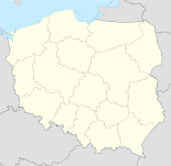
83-022 Suchy DąbWebpräsenz: www.suchy-dab.pl Suchy Dąb (deutsch: Zugdam, kaschubisch: Sëchi Dãb) ist eine Landgemeinde in Polen und liegt im Powiat Gdański der Wojewodschaft Pommern.
Gemeinde
Zur Landgemeinde Suchy Dąb gehören 8 Ortsteile (deutsche Namen bis 1945)[2] mit einem Schulzenamt:
- Grabiny-Zameczek (Herrengrebin)
- Koźliny (Güttland)
- Krzywe Koło (Kriefkohl)
- Osice (Wossitz)
- Ostrowite (Osterwick)
- Steblewo (Stüblau)
- Suchy Dąb (Zugdam)
- Wróblewo (Sperlingsdorf)
Weitere Ortschaften der Gemeinde sind Grabina-Duchowne, Grabowe Pole, Grabowo, Krzywe Koło-Kolonia und Ptaszniki (Vogelgreif).
Fußnoten
- ↑ Population. Size and Structure by Territorial Division. As of December 31, 2010. Główny Urząd Statystyczny (GUS), abgerufen am 6. August 2011.
- ↑ Das Genealogische Orts-Verzeichnis
 Städte und Gemeinden im Powiat Gdański (Landkreis Danzig)
Cedry Wielkie (Groß Zünder) | Kolbudy (Ober Kahlbude) | Pruszcz Gdański (Praust) – Stadt | Pruszcz Gdański-Gmina (Praust-Land) | Przywidz (Mariensee) | Pszczółki (Hohenstein) | Suchy Dąb (Zugdam) | Trąbki Wielkie (Groß-Trampken)
Wikimedia Foundation.
Schlagen Sie auch in anderen Wörterbüchern nach:
Suchy Dab — Original name in latin Suchy Db Name in other language Suchy Dab, Suchy Db, Zugdam State code PL Continent/City Europe/Warsaw longitude 54.20809 latitude 18.76731 altitude 1 Population 832 Date 2010 10 16 … Cities with a population over 1000 database
Gmina Suchy Dąb — Infobox Settlement name = Gmina Suchy Dąb other name = Suchy Dąb Commune settlement type = Gmina total type = Total image shield = subdivision type = Country subdivision name = POL subdivision type1 = Voivodeship subdivision name1 = Pomeranian… … Wikipedia
Гмина Сухы-Домб — Gmina Suchy Dąb Герб Гмина на карте воеводства Страна: Польша Воеводство: Поморское … Википедия
Osice, Poland — Osice Village … Wikipedia
Ostrowite, Gdańsk County — For other places with the same name, see Ostrowite (disambiguation). Ostrowite Village … Wikipedia
Gdańsk County — Powiat gdański County … Wikipedia
Powiat Gdanski — Powiat Gdański … Deutsch Wikipedia
Гмины Поморского воеводства — … Википедия
Сухы-Домб (гмина) — Гмина Сухы Домб Gmina Suchy Dąb Герб … Википедия
Ostrowite — ist ein Ortsname in Polen: Ostrowite (Chojnice), Ort im Powiat Chojnicki der Woiwodschaft Pommern (ehemals Osterwick im Landkreis Konitz, Danzig Westpreußen); siehe Chojnice Ostrowite (Czersk), Ort im Powiat Chojnicki der Woiwodschaft Pommern… … Deutsch Wikipedia
Suchy Dąb


18+
© Academic, 2000-2024
- Kontaktieren Sie uns: Unterstützung, Werbung
Wörterbücher Export, schritte mit PHP, Joomla, Drupal, WordPress, MODx.