- Vatu Vara
-
Vatu Vara Vatu Vara, hier von Westen aus gesehen, hat das Profil eines Hutes
Gewässer Korosee Archipel Lau-Inseln Geographische Lage 17° 26′ S, 179° 31′ W-17.426944444444-179.52333333333Koordinaten: 17° 26′ S, 179° 31′ W 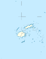

Anzahl der Inseln 1 Hauptinsel Vatu Vara Länge 3,6 km Breite 2,5 km Landfläche 4 km² Gesamtfläche 7 km² Höchste Erhebung 314 m Einwohner (unbewohnt) NASA-Geocover-2000-Satellitenbild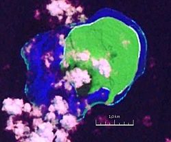
Vatu Vara, wegen ihres Aussehens auch Hat Island genannt,[1] ist eine unbewohnte Insel vulkanischen Ursprungs im Norden des Lau-Archipels im Pazifischen Ozean. Politisch gehört sie zur Eastern Division des Inselstaates Fidschi. Die Insel befindet sich in Privatbesitz und stand für 75 Mio. US$ zum Verkauf, was ihr den Titel der „teuersten Privatinsel der Welt“ einbrachte.[2]
Geographie
Vatu Vara ist die westlichste Insel der Northern Lau Group und liegt 20 km südlich von Yacata, 32 km westlich von Mago sowie 45 km nordwestlich von Cicia. Die aus Korallenkalk aufgebaute Insel misst etwa 2,4 mal 2,1 km (mit dem umgebenden Riff 3,6 mal 2,5 km) und erhebt sich steil bis auf eine Höhe von 314 m aus der Korosee.[3] Vatu Vara stellt ein Gehobenes Atoll vom so genannten Guyot-Typ dar, mit einem tafelbergartigen Gipfel und steilen Kliffs. Die dicht bewachsene Insel ist bis auf eine kleine Stelle im Süden vollständig von einem Korallenriff umsäumt.[3]
Weblinks
- Inoffizielle Homepage der Insel (englisch)
- Ein Profilbild von Vatu Vara auf Panoramio
- Luftbilder von Vatu Vara auf Panoramio
- Weitere Bilder auf flickr
Einzelnachweise
- ↑ Eintrag in geonames.org (englisch)
- ↑ Artikel auf forbes.com vom 2. Januar 2007 (englisch)
- ↑ a b Sailing Directions (enroute), Pub. 126, Pacific Ocean (PDF; englisch)
Kategorien:- Insel (Fidschi)
- Insel (Australien und Ozeanien)
- Insel (Pazifischer Ozean)
- Insel der Lau-Inseln
- Gehobenes Atoll
- Unbewohnte Insel


Wikimedia Foundation.