- Vištuk
-
Vištuk
Wappen Karte 
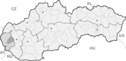

Vištuk BasisdatenKraj: Bratislavský kraj Okres: Pezinok Region: Bratislava Fläche: 20,06 km² Einwohner: 1.392 (31. Dez. 2010) Bevölkerungsdichte: 69,39 Einwohner je km² Höhe: 181 m n.m. Postleitzahl: 900 85 Telefonvorwahl: 0 33 Geographische Lage: 48° 20′ N, 17° 24′ O48.33444444444417.396944444444181Koordinaten: 48° 20′ 4″ N, 17° 23′ 49″ O Kfz-Kennzeichen: PK Gemeindekennziffer: 508322 StrukturGemeindeart: Gemeinde Verwaltung (Stand: März 2010)Bürgermeister: Ľubomír Jelínek Adresse: Obecný úrad Vištuk
353
90085 VištukWebpräsenz: www.vistuk.sk Gemeindeinformation
auf portal.gov.skStatistikinformation
auf statistics.skVištuk (deutsch Wischtu[c]k oder Wischteich, ungarisch Kárpáthalas - bis 1907 Vistuk) ist eine Gemeinde im Bratislavský kraj in der Westslowakei.
Geographie
 Kirche in Vištuk
Der Ort befindet sich im Donautiefland am Bach Vištucký potok und ist 8 km von Modra und 20 km von Trnava entfernt. Bei der Gemeinde befindet sich ein kleiner Stausee (vodná nádrž Vištuk).
Geschichte
Die Gemeinde wurde zum ersten Mal 1244 als Vischa erwähnt und gehörte zum Herrschaftsgut von Burg Rotenstein.
Weblinks
 Commons: Vištuk – Sammlung von Bildern, Videos und AudiodateienGemeinden im Okres Pezinok
Báhoň | Budmerice (Pudmeritz) | Častá (Schattmannsdorf) | Doľany (Ottental) | Dubová (Wernersdorf) | Jablonec (Halmesch) | Limbach | Modra (Modern) | Pezinok (Bösing) | Píla (Sägmühl) | Slovenský Grob (Slowakisch-Eisgrub) | Svätý Jur (Sankt Georgen) | Šenkvice (Schenkwitz) | Štefanová (Stephansdorf) | Viničné (Schweinsbach) | Vinosady | Vištuk (Wischtuk)
Wikimedia Foundation.
Schlagen Sie auch in anderen Wörterbüchern nach:
Vištuk — (Village) Administration Pays Slovaquie … Wikipédia en Français
Vištuk — is a village and municipality in western Slovakia in Pezinok District in the Bratislava region. The town is located north of Senec and east of Modra.HistoryArcheologists found remains of settlements from roughly 5000 BC. The modern history of the … Wikipedia
Bratislava Region — Geobox | Region name = Bratislava other name = category = Region image caption = image caption = symbol = etymology = official name = motto = nickname = country = Slovakia country state = region = district = commune = municipality = border = part … Wikipedia
Modra — Coordinates: 48°19′54″N 17°18′32″E / 48.33167°N 17.30889°E / 48.33167; 17.30889 … Wikipedia
Pezinok District — Infobox Slovak district subject name = Pezinok District region district slovak region = Bratislava Region population = 54,164 (2001) prefix = ? area = 375.53 car plate = PK image location = Okres pezinok.png Pezinok District ( okres Pezinok ) is… … Wikipedia
List of municipalities and towns in Slovakia — Slovakia This is a comprehensive list of municipalities and towns in Slovakia. For lists of towns and municipalities sorted by Regions see the individual articles on Regions. For an outdated list of towns only in Slovakia see also List of towns… … Wikipedia
Doľany, Pezinok District — Pezinok District in the Bratislava region Doľany (Hungarian: Ottóvölgy) is a village and municipality in western Slovakia in Pezinok District in the Bratislava region. External links … Wikipedia
Dubová, Pezinok District — Pezinok District in the Bratislava region Dubová (Hungarian: Cserfalu) is a village and municipality in western Slovakia in Pezinok District in the Bratislava region. External links … Wikipedia
Bahon — Báhoň Wappen Karte … Deutsch Wikipedia
Budmerice — Wappen Karte … Deutsch Wikipedia
Vištuk


18+
© Academic, 2000-2024
- Kontaktieren Sie uns: Unterstützung, Werbung
Wörterbücher Export, schritte mit PHP, Joomla, Drupal, WordPress, MODx.