- Warlubie
-
Warlubie 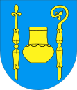
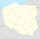

Warlubie Basisdaten Staat: Polen Woiwodschaft: Kujawien-Pommern Landkreis: Świecie Geographische Lage: 53° 35′ N, 18° 38′ O53.58805555555618.626111111111Koordinaten: 53° 35′ 17″ N, 18° 37′ 34″ O Einwohner: 2043 (2008)
Postleitzahl: 86-122 Telefonvorwahl: (+48) 52 Kfz-Kennzeichen: CSW Gemeinde Gemeindeart: Landgemeinde Gemeindegliederung: 35 Ortschaften 9 Schulzenämter Fläche: 201 km² Einwohner: 6623
(31. Dez. 2010) [1]Bevölkerungsdichte: 33 Einw./km² Gemeindenummer (GUS): 0414112 Verwaltung Gemeindevorsteher: Krzysztof Michalak Adresse: ul. Dworcowa 15
86-160 WarlubieWebpräsenz: www.warlubie.pl Warlubie (deutsch Warlubien, 1942–1945 Warlieb) ist ein Dorf und Sitz der gleichnamigen Landgemeinde in Polen. Der Ort liegt im Powiat Świecki der Wojewodschaft Kujawien-Pommern.
Gemeinde
Zur Landgemeinde Warlubie gehören 9 Ortsteile (deutsche Namen bis 1945)[2] mit einem Schulzenamt.
- Bąkowo (Bankau)
- Buśnia (Buschin)
- Bzowo (Groß Sibsau)
- Krusze (Krusch)
- Lipinki (Lippink)
- Płochocin (Groß Plochotschin)
- Płochocinek (Klein Plochotschin, 1942–1945 Klein Plochoczin)
- Warlubie (Warlubien)
- Wielki Komorsk (Käthnerdorf)
Weitere Ortschaften der Gemeinde sind:
- Bąkowski Młyn (Krug Bankauermühle)
- Blizawy (Blissawen)
- Błądziewno (Blondziewno)
- Borowy Młyn (Krug Bankauermühle)
- Borsukowo
- Bursztynowo (Fürstenau)
- Ciemny Las
- Dębowo
- Górna Buśnia (Hoch Buschin)
- Grabowa Góra
- Jeżewnica (Kronfelde)
- Komorsk (Bauerndorf)
- Krzewiny (Schrewin)
- Kurzejewo (Skurzejewo)
- Kuźnica (Hammermühle)
- Mątasek
- Nowa Huta
- Przewodnik (Bülowsheide)
- Rulewo (Rohlau)
- Rybno
- Rynków
- Stara Huta
- Średnia Huta (Mittelhütte)
- Trzy Korony
- Zamczyska (Zomschitz, 1942–1945 Somschitz)
Fußnoten
- ↑ Population. Size and Structure by Territorial Division. As of December 31, 2010. Główny Urząd Statystyczny (GUS), abgerufen am 9. Juli 2011.
- ↑ Das Genealogische Orts-Verzeichnis
Schlagen Sie auch in anderen Wörterbüchern nach:
Warlubie — Infobox Settlement name = Warlubie settlement type = Village total type = image shield = subdivision type = Country subdivision name = POL subdivision type1 = Voivodeship subdivision name1 = Kuyavian Pomeranian subdivision type2 = County… … Wikipedia
Warlubie — Original name in latin Warlubie Name in other language Varljube, Warlubie, Варлюбе State code PL Continent/City Europe/Warsaw longitude 53.58751 latitude 18.63444 altitude 72 Population 2043 Date 2010 09 13 … Cities with a population over 1000 database
Gmina Warlubie — Infobox Settlement name = Gmina Warlubie other name = Warlubie Commune settlement type = Gmina total type = Total image shield = subdivision type = Country subdivision name = POL subdivision type1 = Voivodeship subdivision name1 = Kuyavian… … Wikipedia
Ciemny Las — Village … Wikipedia
Dębowo, Świecie County — For other places with the same name, see Dębowo (disambiguation). Dębowo Village … Wikipedia
Górna Buśnia — Village … Wikipedia
Mątasek — Village … Wikipedia
Nowa Huta, Kuyavian-Pomeranian Voivodeship — For other places with the same name, see Nowa Huta (disambiguation). Nowa Huta Village … Wikipedia
Гмина Варлюбе — Gmina Warlubie Герб Файл:HerbWarlubie.jpg Флаг Файл:FlagaWarlubie.jpg Страна: Польша Повят: Свецкий повят Глава: Кшиштоф Михаляк Площадь: 200,97 км² … Википедия
Voivodeship road — Standard voivodeship roads plates … Wikipedia
Warlubie


18+
© Academic, 2000-2024
- Kontaktieren Sie uns: Unterstützung, Werbung
Wörterbücher Export, schritte mit PHP, Joomla, Drupal, WordPress, MODx.