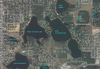
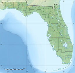
West Crooked Lake (Florida)
Schlagen Sie auch in anderen Wörterbüchern nach:
West Crooked Lake — ist der Name von drei Seen in den Vereinigten Staaten: West Crooked Lake (Florida) West Crooked Lake (Michigan) West Crooked Lake (Minnesota) Diese Seite ist eine Begriffsklärung zur Unterscheidung mehrerer mit demselben Wort … Deutsch Wikipedia
Crooked Lake (Florida) — Crooked Lake Location Polk County, Florida Coordinates 27° 48 55 N 81° 34 00 W Primary outflows Kissimmee River Basin countries United States Surface area … Wikipedia
East Crooked Lake (Florida) — East Crooked Lake NASA Satellitenbild, mit Namen der Seen Geographische Lage Florida, USA Inseln keine … Deutsch Wikipedia
Crooked Lake — (engl. für „Krummer See“) heißen folgende Seen: Crooked Lake (Polk County), in Polk County, Florida Roosevelt Lake, ehemals Crooked Lake, Cass County, Minnesota Crooked Lake (Nova Scotia), in Nova Scotia, Kanada Crooked Lake (Saskatchewan), in… … Deutsch Wikipedia
Florida locations by per capita income — Florida has the eighteenth highest per capita income in the United States of America, at $21,557 (2000). Its personal per capita income is $30,446 (2003).Florida Counties Ranked by Per Capita IncomeThere are sixty seven counties located in… … Wikipedia
Crooked River Light — Location near Carrabelle, Florida Coordinates … Wikipedia
U.S. Route 27 in Florida — This article is about the section of U.S. Route 27 in Florida. For the entire length of the highway, see U.S. Route 27. U.S. Highway 27 … Wikipedia
National Register of Historic Places listings in Polk County, Florida — Location of Polk County in Florida This is a list of the National Register of Historic Places listings in Polk County, Florida. This is intended to be a complete list of the properties and districts on the National Register of Historic Places in… … Wikipedia
Liste der Städte in Florida — Die folgende Liste zeigt alle Kommunen und Siedlungen in Florida. Sie enthält sowohl Citys, Towns und Villages als auch Census designated places (CDP). Die obere Tabelle enthält die Städte mit mehr als 100.000 Einwohnern[1]: Karte von… … Deutsch Wikipedia
Haines City, Florida — City Seal … Wikipedia