- Whitehall (Town, New York)
-
Whitehall 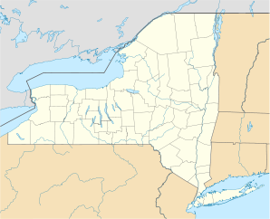

Whitehall Lage in New YorkBasisdaten Staat: Vereinigte Staaten Bundesstaat: New York County: Koordinaten: 43° 33′ N, 73° 24′ W43.554166666667-73.402777777778Koordinaten: 43° 33′ N, 73° 24′ W Zeitzone: Eastern Standard Time (UTC−5) Einwohner: 4035 (Stand: 2000) Bevölkerungsdichte: 27 Einwohner je km² Fläche: 152,2 km² (ca. 59 mi²)
davon 149,2 km² (ca. 58 mi²) LandGNIS-ID: 979636 Whitehall ist eine Town im Washington County, New York in den USA. Im Jahr 2000 hatte die Town 4034 Einwohner. Zur Town gehört auch ein gleichnamiges Village.
Inhaltsverzeichnis
Geschichte
Whitehall wurde 1759 von Hauptmann Philip Skene unter dem Namen Skenesboro gegründet. Die erste Urkunde stammt aus 1765, als der britische König Georg III. dem Gründer das zugehörige Land garantierte. 1777 fand hier ein Gefecht während des Amerikanischen Unabhängigkeitskrieges statt, als während des Saratoga-Feldzuges nach der Schlacht von Ticonderoga britische Truppen die sich zurück ziehenden Amerikaner verfolgten. Whitehall war ebenfalls durch den Britisch-Amerikanischen Krieg betroffen. Die Stadt nennt sich „Geburtsort der US-Marine“.
Nach der Stadt wurde auch ein Begleitzerstörer im 2.Weltkrieg benannt, die USS Whitehall
Geographie
Die nördliche Stadtgrenze ist identisch mit der Grenze zu Vermont. Der New York-Binnenkanal (New York Barge Canal, Champlain Canal) verläuft durch den westlichen Teil der Stadt. Die Stadt hat eine Fläche von 152,2 km², davon sind 149,2 km² Land und 3,0 km² Wasser.
Ortschaften in der Town of Whitehall
- East Whitehall -- Eine Gemeinde an der östlichen Stadtgrenze.
- Grays Corner -- Eine Gemeinde südöstlich des Village of Whitehall.
- Village of Whitehall
Weblinks
Kategorien:- Ort in New York
- Washington County (New York)

Wikimedia Foundation.