- County Roscommon
-
County Roscommon
Contae Ros ComáinKarte 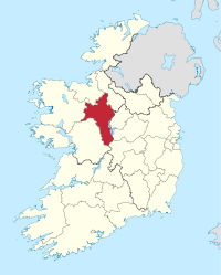
Basisdaten Staat: Irland Verwaltungssitz: Roscommon Provinz: Connacht irischer Name: Ros Comáin Fläche: 2548 km² Einwohner: 63.898 (2011) Kfz-Kennzeichen: RN Roscommon (irisch Ros Comáin) ist eine Grafschaft (county) in der Republik Irland.
Inhaltsverzeichnis
Geografie
Roscommon ist eine binnenländische Grafschaft, die zwischen den Flüssen Shannon im Osten und Suck im Westen liegt. Die Grafschaft ist sehr wasserreich und hat viele Flussläufe, Seen und Moore.
Geschichte
Im Mittelalter gehörte das Gebiet zum Königreich Connacht. 1235 fiel das Gebiet an England, wurde von den Engländern aber nicht besiedelt.
Politik
Die Sitzverteilung im County Council nach der Kommunalwahl vom 5. Juni 2009:
Partei Sitze Fine Gael 10 Fianna Fáil 8 Sinn Féin 1 Parteilose 7 Wirtschaft
In Arigna wurde bis 1990 Kohle abgebaut; seit 2003 befindet sich dort das erste irische Kohlenbergbau-Museum.[1]
Städte
Sehenswürdigkeiten
- Boyle Abbey
- Drumanone
- Rathcroghan, archäologische Fundstätte
- Rindoon Castle, am Westufer des Lough Ree gelegene Burgruine
- Castlestrange Stein
Persönlichkeiten
- Oliver Goldsmith (1728–1774), Schriftsteller und Arzt
- James Wills (1790–1868), Dichter, Autor und Biograf
- John G. Downey (1827–1894), 7. Gouverneur von Kalifornien
- Edward Flanagan (1886–1948), katholischer Priester und Gründer von Boys Town
- Albert Reynolds (* 1932), Politiker und ehemaliger Taoiseach
- Denis Naughten (* 1973), Politiker und Teachta Dála
Weblinks
- Westirland.com (dt.)
Nachweise
 Grafschaften (Countys) der Republik Irland
Carlow | Cavan | Clare | Cork | Donegal | Dublin | Galway | Kerry | Kildare | Kilkenny | Laois | Leitrim | Limerick | Longford | Louth | Mayo | Meath | Monaghan | Offaly | Roscommon | Sligo | Tipperary | Waterford | Westmeath | Wexford | Wicklow
Wikimedia Foundation.
Schlagen Sie auch in anderen Wörterbüchern nach:
County Roscommon — Not to be confused with Roscommon County, Michigan, United States. County Roscommon Contae Ros Comáin … Wikipedia
Old Town, County Roscommon — Old Town an Seanbhaile Town … Wikipedia
Dysart, County Roscommon — Dysart, County Roscommon, Ireland. Dysart is a small village suitated in south County Roscommon on the cross roads of the R363 and the R357. Formally known as Thomas Street(prod name), Dysart village consists of the following : :: 2 Public Houses … Wikipedia
Elphin, County Roscommon — Infobox Irish Place name = Elphin gaeilge = Ail Finn crest motto = map pin coords = left: 58px; top: 40px north coord = 53.85 | west coord = 8.2 | irish grid = M868889 area = | elevation = 83 m province = Connacht county = County Roscommon… … Wikipedia
Drum, County Roscommon — Drum An Droim Town … Wikipedia
Ballinlough, County Roscommon — Infobox Irish Place name = Ballinlough gaeilge = Baille na Locha crest motto = map pin coords = left: 24px; top: 55px north coord = west coord = irish grid = area = elevation = province = Connacht county = County Roscommon population = | town pop … Wikipedia
Boyle, County Roscommon — Infobox Irish Place name = Boyle gaeilge = Mainistir na Búille crest motto = map pin coords = left: 51px; top: 24px north coord = 53.9667 | west coord = 8.3 | irish grid = G803019 area = | elevation = 83 m province = Connacht county = County… … Wikipedia
Ballintober, County Roscommon — Infobox Irish Place name = Ballintober gaeilge = Baile an Tobair crest motto = map pin coords = left: 42px; top: 59px north coord = 53.7167 | west coord = 8.4167 | irish grid = M725741 area = | elevation = 83 m province = Connacht county = County … Wikipedia
Croghan, County Roscommon — Croghan (Irish: Cruachán, meaning A Round Natural Hill ), is a townland in the County Roscommon, Ireland. Famous People Associated With The Area St Remix of Croghan Categories: Towns and villages in County RoscommonIreland geography stubs … Wikipedia
Roscommon County (Parliament of Ireland constituency) — Roscommon County Former County constituency Created () Post Union Type Irish House of Commons Roscommon County was a constituency represented in the Irish House of Commons from 1611 to 1800 … Wikipedia
County Roscommon

18+
© Academic, 2000-2024
- Kontaktieren Sie uns: Unterstützung, Werbung
Wörterbücher Export, schritte mit PHP, Joomla, Drupal, WordPress, MODx.