Drexel Heights — Drexel Heights, AZ U.S. Census Designated Place in Arizona Population (2000): 23849 Housing Units (2000): 7957 Land area (2000): 19.676093 sq. miles (50.960845 sq. km) Water area (2000): 0.000000 sq. miles (0.000000 sq. km) Total area (2000):… … StarDict's U.S. Gazetteer Places
Drexel Heights, AZ — U.S. Census Designated Place in Arizona Population (2000): 23849 Housing Units (2000): 7957 Land area (2000): 19.676093 sq. miles (50.960845 sq. km) Water area (2000): 0.000000 sq. miles (0.000000 sq. km) Total area (2000): 19.676093 sq. miles… … StarDict's U.S. Gazetteer Places
Drexel Heights — Original name in latin Drexel Heights Name in other language State code US Continent/City America/Phoenix longitude 32.14119 latitude 111.02843 altitude 770 Population 27749 Date 2011 05 14 … Cities with a population over 1000 database
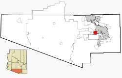
Drexel Heights, Arizona — CDP Location in … Wikipedia
Drexel — ist der Name mehrerer Orte in den Vereinigten Staaten: Drexel (Florida) Drexel (Missouri) Drexel (Montana) Drexel (North Carolina) Drexel (Ohio) Drexel Gardens (Indiana) Drexel Heights (Arizona) Drexel Hill (Pennsylvania) Drexel Hills… … Deutsch Wikipedia
Drexel-Alvernon, Arizona — CDP Location in … Wikipedia
Drexel, Ohio — CDP Coordinates … Wikipedia
Drexel Hill, Pennsylvania — Coordinates: 39°57′00″N 75°18′07″W / 39.95°N 75.30194°W / 39.95; 75.30194 … Wikipedia
Drexel, Katharine, Saint — ▪ Roman Catholic nun born November 26, 1858, Philadelphia, Pennsylvania, U.S. died March 3, 1955, Cornwells Heights; feast day [U.S.] March 3 American founder of the Blessed Sacrament Sisters for Indians and Colored People (now Sisters of… … Universalium
Drexel, Saint Katherine — born Nov. 26, 1858, Philadelphia, Pa., U.S. died March 3, 1955, Cornwells Heights, Pa.; canonized Oct. 1, 2000; feast day March 3 U.S. missionary. The niece of banker and philanthropist Anthony J. Drexel, she inherited a vast fortune, which she… … Universalium
 Lage im County und in Arizona