Dunnose Head

Dunnose Head
-51.75575-60.418694444444
Dunnose Head (Falklandinseln)
Dunnose Head
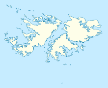
Dunnose Head

Dunnose Head ist einer der westlichsten Wohnplätze auf der sehr dünn besiedelten Westfalkland-Insel. Die Ansiedlung besteht aus einer gleichnamigen Farm, auf der Schafzucht betrieben wird. Die Farm liegt einsam auf einer Halbinsel etwa 80 Kilometer südwestlich von Port Howard. Sie ist nur durch einen unbefestigten Fahrweg zu erreichen.

Weblinks


Wikimedia Foundation.

Игры ⚽ Нужно сделать НИР?

Schlagen Sie auch in anderen Wörterbüchern nach:

  • Dunnose Head — is a small settlement on West Falkland, on Philomel Pass on Queen Charlotte Bay of Bay. It is about 80km west south west of Port Howard, and does not have a proper road connection. It used to be part of Packe Brothers Ltd holdings, but on sub… …   Wikipedia

  • HMS Eurydice (1841) — HMS Eurydice was a 24 gun frigate which was the victim of one of Britain s worst peace time naval disasters when she sank in 1878.Origins of the Eurydice Designed by Admiral the Hon. G. Elliot, the second Eurydice was a very fast 24 26 gun… …   Wikipedia

  • Gran Malvina — Westfalkland Westfalkland (spanisch Gran Malvina ) ist mit 4.532 km² (5.413 km² inklusive der kleineren vorgelagerten Inseln) die zweitgrößte der Falklandinseln. Die hügelige Insel wird durch den Falklandsund von Ostfalkland getrennt. Höchster… …   Deutsch Wikipedia

  • West-Falkland — Westfalkland Westfalkland (spanisch Gran Malvina ) ist mit 4.532 km² (5.413 km² inklusive der kleineren vorgelagerten Inseln) die zweitgrößte der Falklandinseln. Die hügelige Insel wird durch den Falklandsund von Ostfalkland getrennt. Höchster… …   Deutsch Wikipedia

  • West Falkland — Westfalkland Westfalkland (spanisch Gran Malvina ) ist mit 4.532 km² (5.413 km² inklusive der kleineren vorgelagerten Inseln) die zweitgrößte der Falklandinseln. Die hügelige Insel wird durch den Falklandsund von Ostfalkland getrennt. Höchster… …   Deutsch Wikipedia

  • West Falkland — Infobox Falkland island MapCaption= latitude= 51.7975 longitude= 60.1319 coordinates= coord|51|47|51|S|60|07|55|W|display=inline,title island group= english name=West Falkland spanish name=Gran Malvina meaning of name=Spanish: Large Falkland… …   Wikipedia

  • Toponimia de las islas Malvinas — Mapa de las Islas Malvinas, con la toponimia argentina (clicar en la imagen para agrandarla) …   Wikipedia Español

  • List of settlements in the Falkland Islands — This is a list of towns and settlements on the Falkland Islands.*Ajax Bay (East Falkland) *Beaver Settlement (on Beaver Island) *Bluff Cove Settlement *Bombilia House *Burnside House *Camp Verde (Campo Verde) *Carcass Island Settlement (see Port… …   Wikipedia

  • Passage Islands — Infobox Falkland island MapCaption=Location of the Passage Islands within the Falkland Islands latitude= longitude= coordinates= island group= english name= Passage Islands spanish name=Islas del Pasaje meaning of name= area= area rank= highest… …   Wikipedia

  • King George Bay — Disambiguation: there is also a King George Bay on King George Island King George Bay ( es. Bahia 9 de Julio) is a large bay on the coast of West Falkland in the Falkland Islands, facing westwards. There are three settlements on the bay Chartres …   Wikipedia

Share the article and excerpts

Direct link
Do a right-click on the link above
and select “Copy Link”