- Afon Dyfrdwy
-
Dee 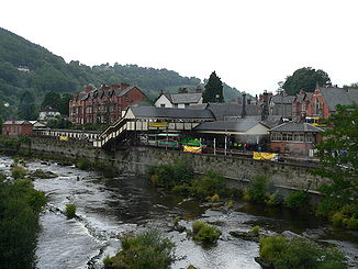
Der Dee bei Llangollen
Daten Lage _svg.png) Wales,
Wales,  England
Länge 110 km Quelle am Osthang des Dduallt
52° 49′ 54″ N, 3° 45′ 45″ W52.831666666667-3.7625450Quellhöhe ca. 450 m Mündung nordwestlich Chester in die Irische See53.338055555556-3.21583333333330Koordinaten: 53° 20′ 17″ N, 3° 12′ 57″ W
53° 20′ 17″ N, 3° 12′ 57″ W53.338055555556-3.21583333333330Mündungshöhe 0 m Höhenunterschied ca. 450 m Einzugsgebiet 1816,8 km2[1] Abflussmenge MQ: 29,71 m³/s Der Dee, walisisch Afon Dyfrdwy, ist ein etwa 110 km langer Fluss im nördlichen Wales, der sich in die Irische See ergießt.
Der Dee entspringt in der Grafschaft Gwynedd an den Hängen des Dduallt in Snowdonia und fließt auf kurzem Weg zum Balasee. Von da aus wendet sich der Flusslauf nach Nordosten zur Ortschaft Corwen und dann ostwärts an Llangollen vorbei. Im Tal von Llangollen fließt der Dee unter dem von Thomas Telford 1805 für den Shropshire-Union-Kanal gebauten Pontcysyllte-Aquädukt hindurch.
Nachdem der Dee die walisische Bergregion verlassen hat, fließt er in Windungen nordwärts durch die Ebene von Cheshire auf Chester zu; hinter Chester wurde der Flusslauf kanalisiert. Die Mündung des Dee ist 19 km lang und 8 km breit, sehr seicht, mit Sandbänken und Marschen; der Hauptort an der Flussmündung ist Flint.
Einzelnachweise

Wikimedia Foundation.