- Agligadak Island
-
Agligadak Island Gewässer Pazifischer Ozean Inselgruppe Aleuten Geographische Lage 52° 6′ 15″ N, 172° 54′ 4″ W52.104167-172.9011111Koordinaten: 52° 6′ 15″ N, 172° 54′ 4″ W 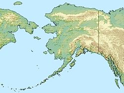

Länge 320 m Einwohner (unbewohnt) Agligadak Island ist eine kleine unbewohnte Insel der Andreanof Islands, die zu den Aleuten gehören. Die nur etwa 300 m lange Insel liegt 5 km östlich von Amlia Island entfernt.
Das Eiland wurde erstmals 1852 von Mikhail Tebenkov als Ostrov Agligadak in den Seekarten verzeichnet. Der Name Agligadak bedeutet auf Aleutisch so viel wie Albatros.
Weblinks
Inseln und Inselgruppen der Andreanof IslandsAdak | Agligadak | Amatigis Islands | Amlia | Anagaksik | Argonne | Asuksak | Atka | Aziak | Barbara | Black | Bobrof | Bolshoi Islands | Box | Castle | Chaika Rock | Channel | Chisak | Chugul | Cone | Cormorant | Crone | Delarof Islands | Dora | Eddy | Elf | Fenimore Rock | Gramp Rock | Great Sitkin | Green | Igitkin | Ikiginak | Ina | Kagalaska | Kanaga | Kanu | Kasatochi | Koniuji | Little Tanaga | North | Oglodak | Plum | Ringgold | Sadatanek | Sagchudak | Sagigik | Salt | Sea Parrot | Seguam | Silak | South | Staten | Tagadak | Tagalak | Tanaga | Tanaklek | The Signals | The Three Sisters | Tidgituk | Umak | Uyak | Whip
Wikimedia Foundation.
Schlagen Sie auch in anderen Wörterbüchern nach:
Adak Island — Mount Adagdak Gewässer Pazifischer Ozean Inselgruppe … Deutsch Wikipedia
Igitkin Island — Vorlage:Infobox Insel/Wartung/Fläche fehltVorlage:Infobox Insel/Wartung/Höhe fehlt Igitkin Island Igitkin Island, im Hintergrund Great … Deutsch Wikipedia
Bobrof Island — Vorlage:Infobox Insel/Wartung/Fläche fehlt Bobrof Island NASA Bild von Bobrof Island Gewässer … Deutsch Wikipedia
Kanu Island — Vorlage:Infobox Insel/Wartung/Bild fehltVorlage:Infobox Insel/Wartung/Fläche fehlt Kanu Island Gewässer Pazifischer Ozean Inselgruppe Aleuten Geographische Lage … Deutsch Wikipedia
Kasatochi Island — Vorlage:Infobox Insel/Wartung/Fläche fehlt Kasatochi Island Der Kratersee auf Kasatochi Gewässer … Deutsch Wikipedia
Amlia Island — Vorlage:Infobox Insel/Wartung/Bild fehlt Amlia Island Gewässer Pazifischer Ozean Inselgruppe Aleuten Geographische Lage … Deutsch Wikipedia
Koniuji Island — Gewässer Pazifischer Ozean Inselgruppe … Deutsch Wikipedia
Little Tanaga Island — Vorlage:Infobox Insel/Wartung/Fläche fehlt Little Tanaga Island NASA Bild von Little Tanaga Island Gewässer … Deutsch Wikipedia
Seguam Island — Vorlage:Infobox Insel/Wartung/Höhe fehlt Seguam Island NASA Bild von Seguam Island Gewässer Pazifischer Ozean … Deutsch Wikipedia
Tanaga Island — Mount Tanaga auf Tanaga Island Gewässer Pazifischer Ozean Inselgruppe … Deutsch Wikipedia
Agligadak Island

18+
© Academic, 2000-2024
- Kontaktieren Sie uns: Unterstützung, Werbung
Wörterbücher Export, schritte mit PHP, Joomla, Drupal, WordPress, MODx.